Into the Outer Banks
Living not far from the Outer Banks, my wife, Sandy, and I have visited there often--and each time, as we glided farther and farther into the Atlantic Ocean, I was stirred by the strange sensation that I was navigating a boat rather than a car. Maybe not so strange, actually, when windswept waves stretch for miles on either side.
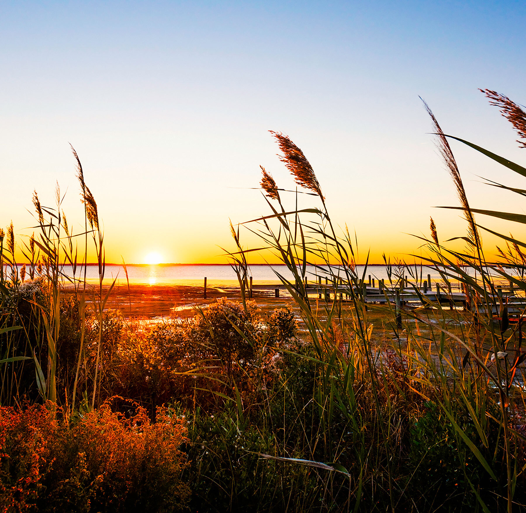
July and August are peak season for surf and sun. A family playground, the islands hawk all the expected beach amusements: parasailing, waterskiing, Jet Skiing, canoeing, kayaking, sailboarding, deep-sea fishing, and horseback riding. But any time of year is fulfilling. I've gone in midwinter to hike miles of empty beaches, watching the spindle-legged shorebirds probing the sand for lunch.
Day one: Norfolk to Kill Devil Hills
The drive from Norfolk, Va., passes through mostly flat coastal farm country, and in mid-summer roadside stands sell fresh corn and other produce. After the flatlands, the lofty sand dunes of the Outer Banks seem almost like mountains. At their widest, between Kitty Hawk and Nags Head, the Outer Banks expand to about a mile. This is where you find the most popular beaches--the ones that draw the summer throngs. In the heart of the bustle, little Kill Devil Hills, a family resort town, provides the beach time you crave plus a look at one of America's most historical spots.
Check into the tidy 54-room Cavalier Motel, which nudges right up to the beach dunes. Soak up some sunshine at the pool or the beach, but save time for a visit to the Wright Brothers National Memorial, just a few minutes away.
On a sand-covered site at Kill Devil Hills a century ago, Orville and Wilbur Wright launched the first manned heavier-than-air craft to leave the ground by its own power. The flight lasted all of 12 seconds, and the plane, with Orville at the helm, covered less distance than the length of a modern airliner. But air travel was born. Markers indicate the takeoff and landing spots--so close together that it seems the brothers might more easily have jumped. The visitors center displays a replica of their aircraft; atop Big Kill Devil Hill, an impressive granite monument pays tribute to their achievement. Rising to 90 feet, the hill is one of the highest spots in the Outer Banks--make the climb for a 360-degree view.
Afterward, join the crowds at Pigman's Bar-B-Que, a no-frills joint. You can't go wrong with the messy pork ribs, which are served with coleslaw, baked beans, and plump hush puppies.
Day two: Kill Devil Hills to Manteo
Today's drive temporarily leaves the Atlantic shore for 13-mile-long Roanoke Island, behind the Outer Banks in Roanoke Sound.
Start the morning by testing your courage. See that line of folks on the high dune in the distance? They're waiting for their Wright moment. Hang-gliding lessons are a major activity at Jockey's Ridge State Park. The fragile aircraft are launched from 80-foot-high sand dunes. Kitty Hawk Kites, the world's largest hang-gliding school, has a three-hour introductory course (including five solo flights). You can expect to cover up to 75 yards. Some gliders, maneuvered by confident, well-coordinated students, float gracefully back to earth. Others plummet with a seemingly painful thud into the not-so-yielding sand. Too scared? Stop by anyway to watch the often comical antics of the first-timers. You'll want to hike the dunes to the launch area for a close-up look. An exhibit in the park visitors center notes that the surface of the sand here can exceed the air temperature by 30 degrees. Take heed: Wear shoes.
On to the waterside village of Manteo, where Sandy and I check into the Dare Haven Motel, about 10 minutes from the beach. We head first for the harbor on Shallowbag Bay. Sailboats drift over the sound, and just across an inlet rests the 69-foot Elizabeth II. The featured attraction at Roanoke Island Festival Park, this replica of a 16th-century sailboat represents the type of ship that carried English colonists to the New World during the reign of Elizabeth I. Onboard, costumed interpreters answer our questions, speaking with Old English accents. Questions, naturally, tend to be about the Roanoke mystery. In May 1587, three British ships carried 117 settlers to Roanoke.
A week later, the colony's governor sailed back to England for supplies. The threat of the Spanish Armada delayed his return for three years. When the governor finally made it back in 1590, the colony had vanished. Historians can only speculate on what happened.
There are re-creations of the first settlement site (talk to the "colonists") and an Algonquin village, and at the Roanoke Adventure Museum youngsters can don Elizabethan garb or learn about Blackbeard's visits to the Outer Banks. Nearby, Fort Raleigh National Historic Site marks the location of the ill-fated colony. The formal Elizabethan Gardens memorialize the colonists.
Adjacent to the fort, the mystery is dramatized in an outdoor theatrical spectacle, The Lost Colony, with clashing swords and fireworks; it's presented nightly (except Sunday) in the summer (May 31-August 20). Kids might find it tedious, but I, a history major, was interested.
Grab some dinner at Big Al's Soda Fountain and Grill, a '50s-era café with an all-American menu; fresh seafood dinners with fries and slaw cost about $14.
Or ditch The Lost Colony and go howling with the wolves. It's one of the offbeat nature programs sponsored by the Alligator River National Wildlife Refuge, west of Manteo. Until the 18th century, red wolves roamed the area, but then they disappeared. Eight wolves were reintroduced onto the 152,000-acre refuge in the late 1980s; the population has since grown to more than 95 and has spread throughout the refuge and beyond. Children love to howl, and parents aren't shy about joining in. If everybody gets the sounds right, the wolves usually howl in reply. Two-hour "safaris" begin at 8 p.m. on summer Wednesdays.
Day three: Manteo to Buxton
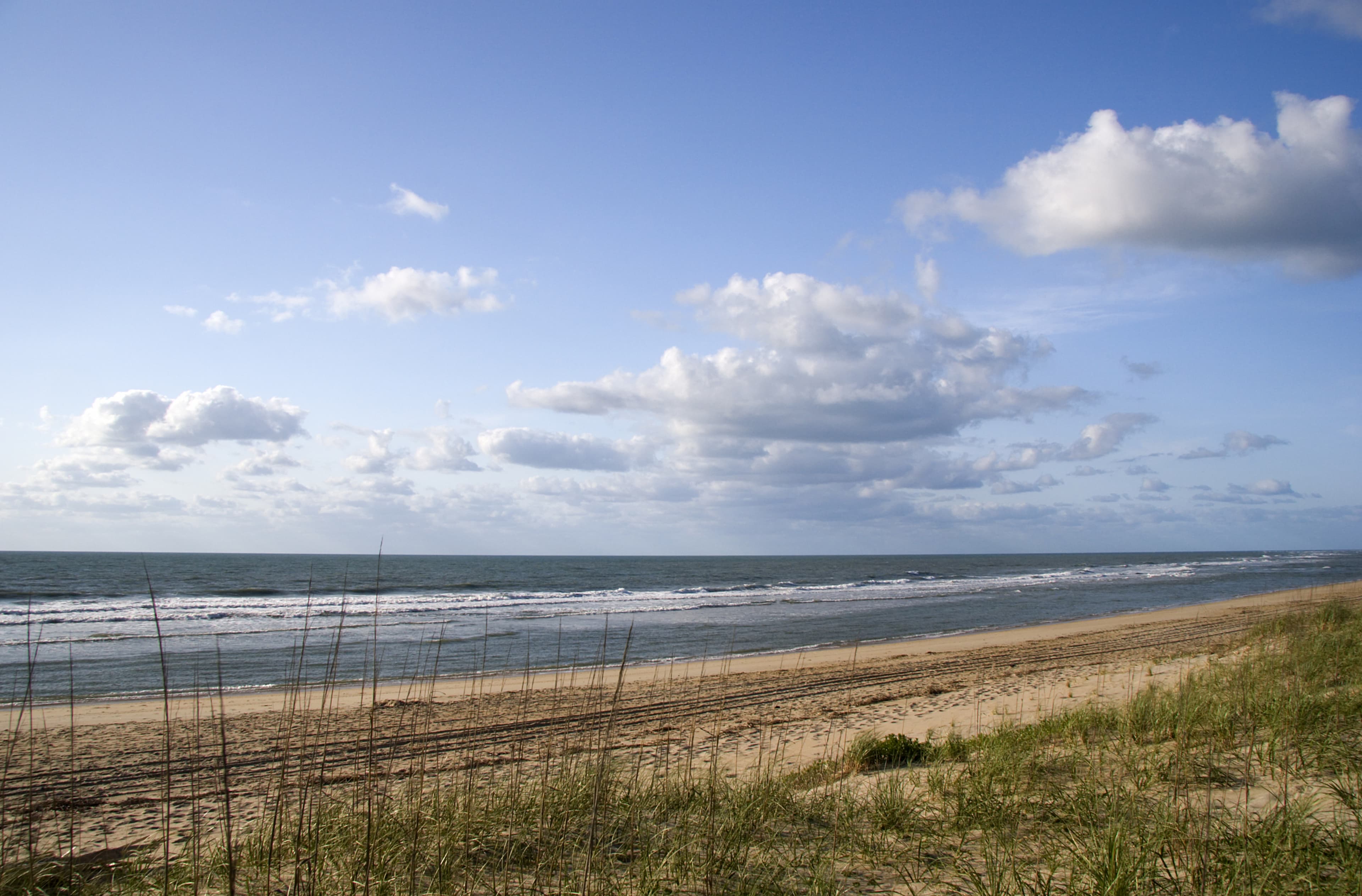
This is the Outer Banks I like best, the quiet southern end. The islands narrow considerably here; at their skinniest, only a few hundred yards separate the rough Atlantic from calm Pamlico Sound. Much of the seashore is protected, either as Pea Island National Wildlife Refuge or Cape Hatteras National Seashore. You'll find miles of nearly desolate beaches, their wild beauty mostly untouched except by wind and sea. Towering dunes topped by wind-stunted trees frequently block sight of the ocean. But there are stairways at the many pullouts along the way. Keep your swim trunks handy.
The 156-foot-high Bodie Island Lighthouse serves as a visitors center for the Cape Hatteras National Seashore. Exhibits illustrate the early seafaring dangers in the area. As many as 600 ships have wrecked on the shifting coastline since 1526, earning it the unhappy nickname Graveyard of the Atlantic.
South of the lighthouse, the road hops from Bodie Island to Hatteras Island over an arched bridge and long causeway. At the end, stop at Pea Island National Wildlife Refuge. Nearly 400 species of birds have been identified here, including odd migrants blown off course by fierce Atlantic storms. Learn also about the Oriental, a Civil War steamer that struck a sandbar and sunk. The ship's boiler is visible in the surf.
At either visitors center, be sure to check out the ranger-led activities, which are free or minimally priced. Canoe on the sound, take a bird-watching walk, learn how to catch crabs, build a kite, or go snorkeling or fishing.
South of Avon, a small day-use park called Canadian Hole draws windsurfing throngs, who flit like butterflies across the flat waters of Pamlico Sound. The steady winds and shallow water are said to be ideal for novices.
At Cape Hatteras, test your leg muscles by climbing the 268 steps to the top of the still-operating Cape Hatteras Lighthouse--at 210 feet, it's the tallest brick lighthouse in the U.S. Built in 1870, it was threatened by erosion for many years--until 1999, when it was moved a half mile inland.
Spend the night in the sound-side village of Buxton, a mile from the lighthouse, Dine across the highway at the Diamond Shoals Restaurant, named for a bank of shifting sand ridges hidden in the treacherous waters off Cape Hatteras. On the family-friendly menu, try the catch of the day, usually sea trout ($13.95). And then return next morning for one of the famous hearty breakfasts.
Day four: Ocracoke and Back to Norfolk
In the morning, we catch the free car ferry to Ocracoke Island. The road to the landing passes through one of the areas hit hardest by the hurricane, and you're still likely to see some damage. Waves briefly washed out the road between Frisco and Hatteras, creating a temporary inlet between the Atlantic and the sound. But the road has since been reopened.
The ferry takes 40 minutes. On Ocracoke, Highway 12 continues for another 13 miles through the mostly untouched seascapes of Cape Hatteras National Seashore to the village of Ocracoke and the Ocracoke Lighthouse. (The highway is sometimes closed during bad weather, so check with the highway department.) En route, stop at the Pony Pasture, a 100-acre field nurturing a small herd of the island's unique ponies, possibly descendants of Spanish ponies that survived a shipwreck. Unlike other horses, Ocracoke ponies have one fewer rib--17 instead of 18.
Then ferry back to Hatteras, Buxton, and the beach. After the history lessons, you've earned more playtime.
Finding your way
The closest major airport to the Outer Banks is in Norfolk, Va., about 70 miles to the north. Southwest Airlines provides service from most of the country. A car is essential; at summer's peak, expect to pay $130 to $140 for a week's rental of a compact with unlimited mileage. The Outer Banks Visitors Bureau (877/629-4386, outerbanks.org) distributes a 112-page travel guide. Call for a copy, or pick one up at the visitors bureau. It's a mile past the Currituck Sound Bridge (U.S. 158), in Kitty Hawk.
1. Norfolk to Kill Devil Hills
From the Norfolk airport, take I-64 south to Virginia State Route 168 south. In Barco, N.C., pick up U.S. 158 south via Kitty Hawk to Kill Devil Hills. U.S. 158 is the speedier bypass to Kill Devil Hills, ending a few miles beyond the town. Along here you'll find many restaurants, service stations, and other tourist facilities. Paralleling it is Highway 12, the old beach road, which runs the length of the Outer Banks from Corolla in the north to the southern tip (via ferry) of Ocracoke Island. On Highway 12, the slow road, you're finally at the beach.
2. Kill Devil Hills to Manteo
Continue south on U.S. 158 to U.S. 64/264 west across Roanoke Sound to Roanoke Island and Manteo.
3. Manteo to Buxton
Double back to U.S. 158/Highway 12, continuing south on Highway 12 to Buxton.
4. Ocracoke and back to Norfolk
From Buxton, follow Highway 12 to the end of the pavement and the dock for the Ocracoke ferry. The 30-car ferries operate year-round; in summer, they depart to and from Ocracoke every 30 to 60 minutes. On Ocracoke, pick up Highway 12 and follow it to its end in the village of Ocracoke. Then retrace your route back to the mainland and Norfolk.