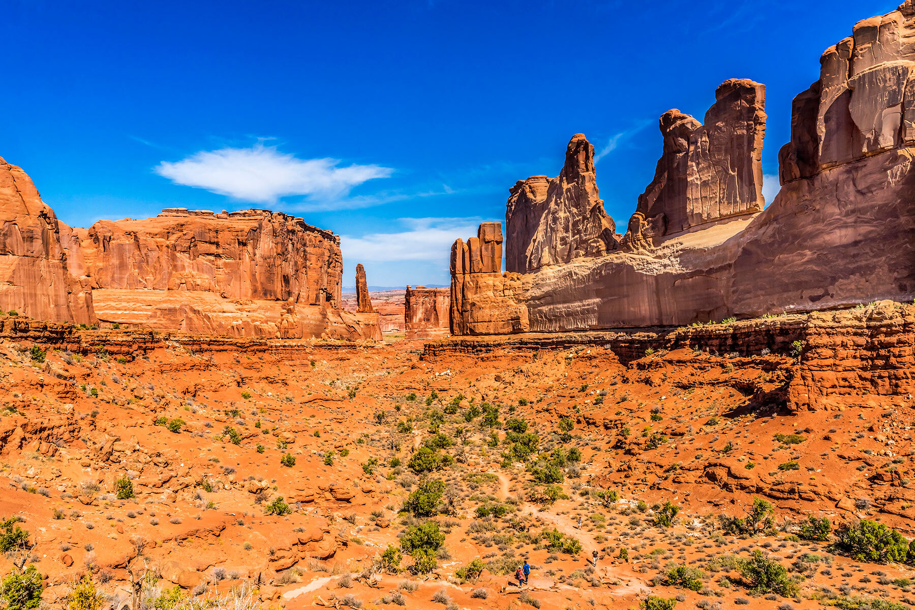
3 rad road trips to visit Utah’s best state parks

By Martha Anderson
March 29, 2021
Goblin Valley
Julian Fong, Flickr Creative Commons License

With so many spectacular national parks in Utah, its state parks are often overlooked. But don't sleep on them, Utah is one of the most beautiful states in America!To help you in your quest to visit these under-appreciated areas, we’ve gathered basic itineraries for three road trips that take you to 11 of Utah’s best state parks. 

Remember to do research ahead of time if you’re traveling during the era of COVID-19. Not all visitor centers may be open, and typical gear rental options may not be available.

Wasatch Mountain
Wasatch Mountain. Photo by Ken Lund, Flickr Creative Commons License.

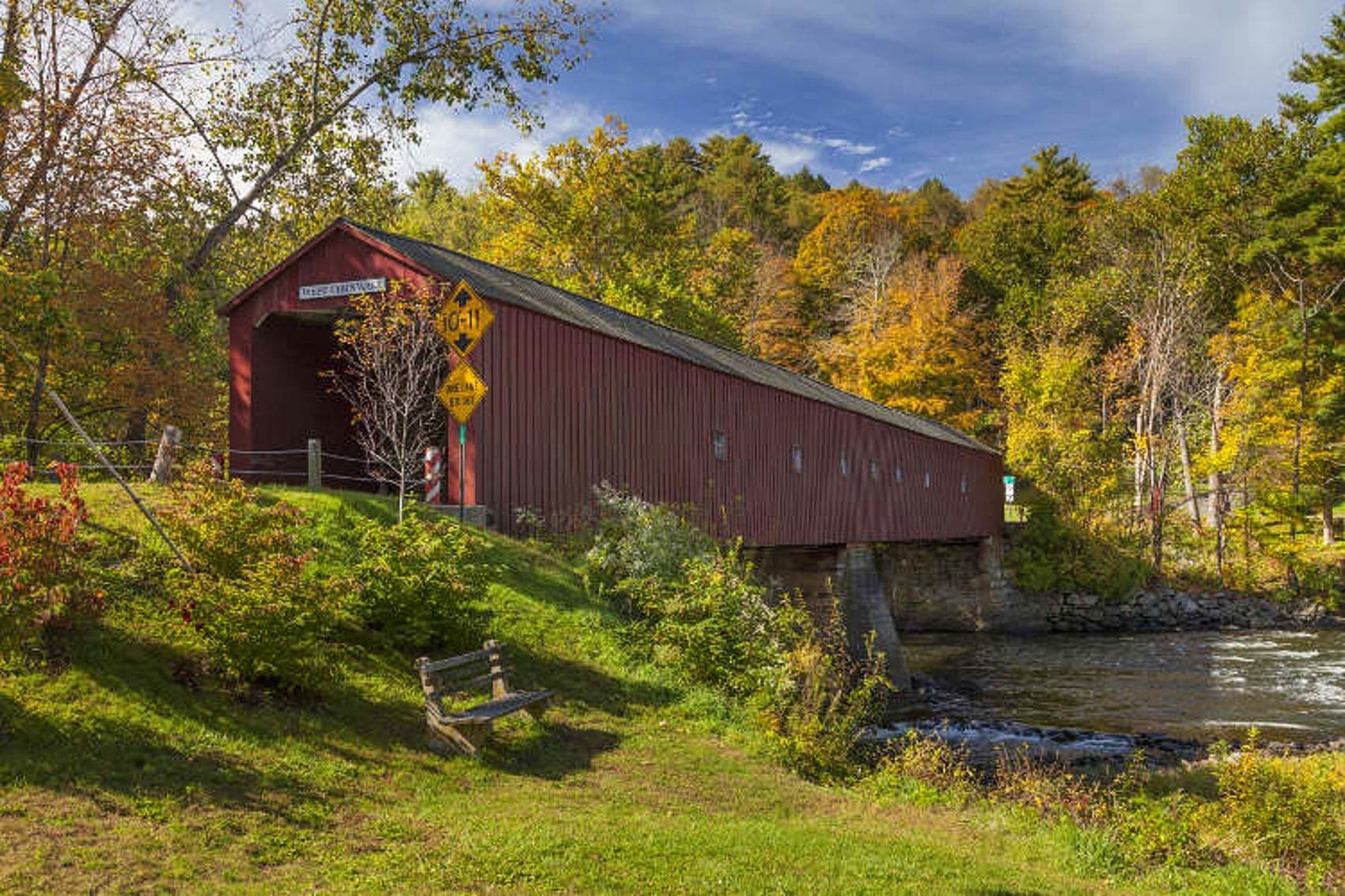
Road Trip #1: Antelope Island, Wasatch Mountain, and Millsite 

Often, red rocks are the only thing associated with Utah’s nature scene, but this landscape is only one part of what Utah offers. Embark on this three-day road trip to see what we mean. 


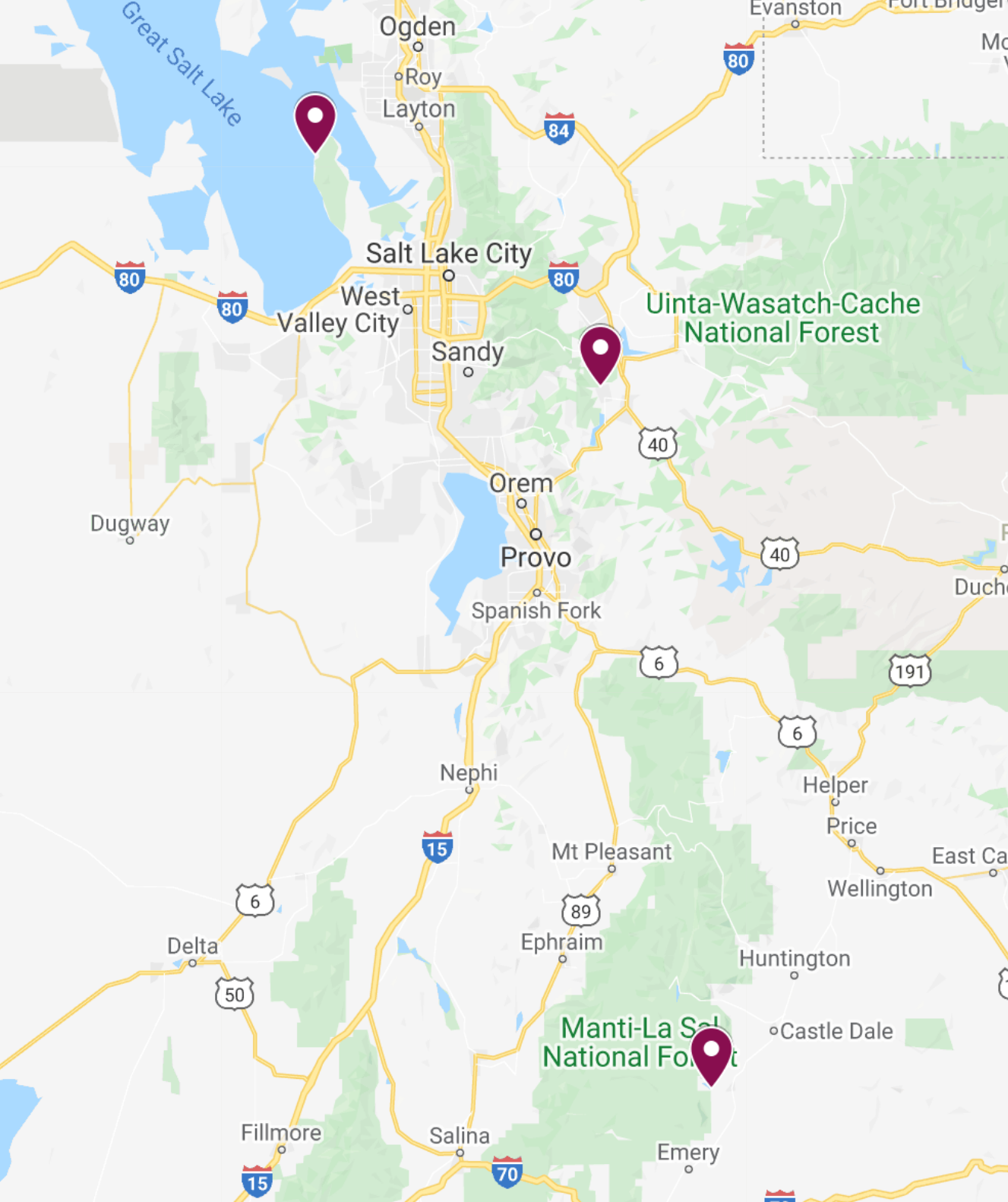
Parks on Road Trip #1

Day 1: Antelope Island State Park

After entering the park, hike the 1-mile Buffalo Point Trail, stopping to soak in views of Antelope Island and the Great Salt Lake. Once you’ve worked up a sweat, head down to take a dip at Bridger Bay Beach. After you’re done bobbing around in the salty water, drive the rest of the park's road. Be sure to keep your eyes peeled for large animals such as bison, pronghorn, mule deer, and bighorn sheep.

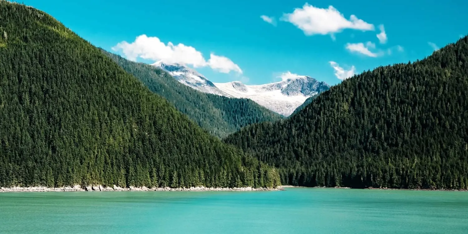
Day 2: Wasatch Mountain State Park

Distance from Antelope Island: 1 hour, 30 minutes

Hike the 6.1-mile trail to Lake Mary via Catherine Pass. Just be sure to get an early start and have a backup plan for parking as this is a popular trail. If you’re comfortable with adding on less than a mile, take two detours to visit Lake Catherine and Lake Martha while you’re on the trail. 

Day 3: Millsite State Park

Distance from Wasatch Mountain: 3 hours

Bring your water vessel of choice for a phenomenal day of paddling on the beautiful waters of the Millsite Reservoir. With stunning views all around, you won’t want to get out of the water.


Dead Horse Point State Park. Photo by Fabio Achilli. Flickr Creative Commons lIcense.

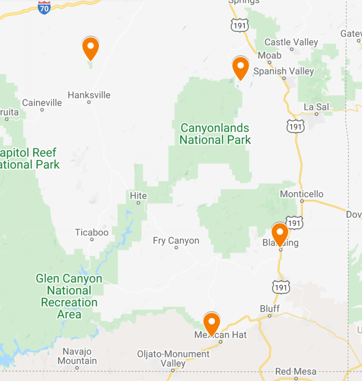
Road Trip #2: Goblin Valley, Dead Horse Point, Edge of the Cedars, and Goosenecks

This three-day road trip showcases both the natural and cultural resources Utah has to offer by delivering otherworldly views and teaching you about Anasazi history.


Parks on Road Trip #2

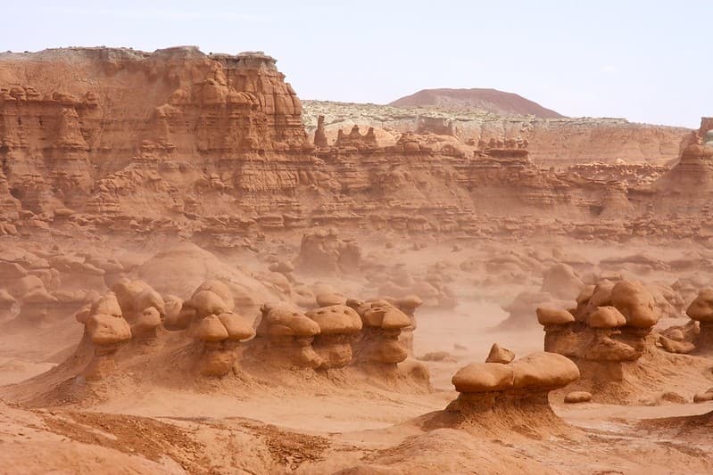
Day 1: Goblin Valley State Park

Venture to another planet on your first stop of this road trip. Goblin Valley State Park transports you to Mars as you hike among astonishing sandstone formations. Explore the Valley of Goblins, a free-roaming area without trails. Once you’re ready for a slight change in scenery, head to the campground with a frisbee (or rent one) to play on one of the most unique 9-hole disc golf courses you’ll ever find.

Day 2: Dead Horse Point State Park

Distance from Goblin Valley: 1 hour, 45 minutes

This often-forgotten Moab state park offers similar views to Canyonlands National Park with far fewer visitors to share them with. Complete the 5-mile loop on the rim to hit as many scenic overlooks as possible.

Day 3, Part 1: Edge of the Cedars State Park

Distance from Dead Horse Point: 2 hours

At this park, you’ll step away from the focus on natural resources and turn your attention towards history and culture instead. Edge of the Cedars State Park includes a museum housing fascinating exhibits such as an incredible collection of Ancestral Puebloan pottery. After you’ve finished exploring the museum, gain a better understanding of how people used to live there by wandering the ruins outside. You even have the opportunity to enter a 1,000-year-old kiva!

Day 3, Part 2: Goosenecks State Park

Distance from Edge of the Cedars: 1 hour

After you’ve finished exploring Edge of the Cedars, take the short drive to Goosenecks State Park. Goosenecks is an interesting park in that it does not hold any hiking or biking trails within its boundaries. This means it’s best to simply enjoy the park via an overlook accessed by your vehicle. Bring a picnic to extend your time spent watching the San Juan River carving the rock below.


Kodachrome Basin State Park. Photo by Jeff Hollett, Flicker creative commons license.

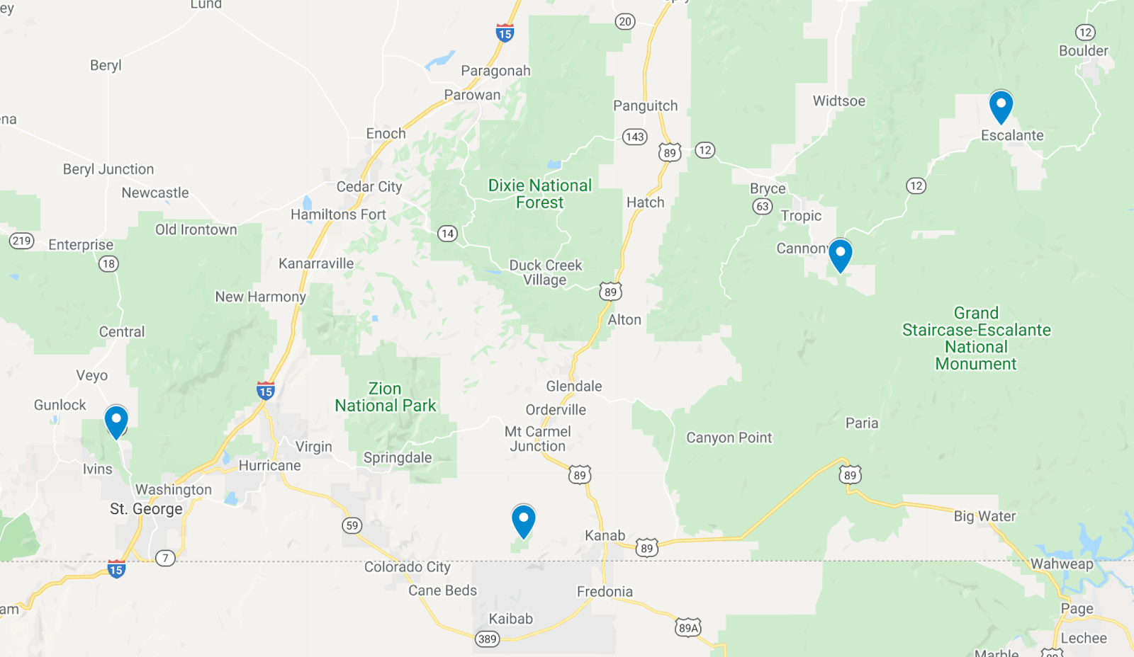
Road Trip #3: Escalante Petrified Forest, Kodachrome Basin, Coral Pink Sand Dunes, and Snow Canyon

This four-day road trip incorporates quite a few unique activities in Southern Utah, including sandboarding, geocaching, and hiking inside lava tubes!


Parks on Road Trip #3

Day 1: Escalante Petrified Forest State Park

After stopping by the visitor’s center to learn about petrified wood and how it’s formed, take a stroll through the park to see this magnificent phenomenon with your own eyes. A 2-mile trail combining the Petrified Forest Trail and the Sleeping Rainbows Trail will take you through lava flows and oodles of petrified wood.

Day 2: Kodachrome Basin State Park

Distance from Escalante Petrified Forest: 1 hour

Explore the towering spires of Kodachrome Basin State Park by foot! The park has put together a geocache challenge that takes you on four trails. GPS coordinates for this challenge are found on Kodachrome Basin’s website. Save the geocache located on the Cool Cave loop for last so you can traverse the rest of the 6-mile Panorama Trail loop if you have the time (and energy).

Day 3: Coral Pink Sand Dunes State Park

Distance from Kodachrome Basin: 2 hours

Bring along (or rent) a sled or snowboard to shred some sand in this wild landscape of sand dunes. Once you’re ready for a change of activity, go explore the dunes on foot! Just be sure to stay aware of ATVs as off-roading is a popular activity in the park.

Day 4: Snow Canyon State Park

Distance from Coral Pink Sand Dunes: 1 hour, 30 minutes

Finish up your road trip with a long day of two hikes at Snow Canyon State Park. The first is the 4.8-mile Snow Canyon Overlook Trail, one that rewards you with a remarkable view at the end. The second is the 2.3-mile Lava Tube Trail, one offering the rare experience of meandering through–you guessed it–lava tubes! 

We hope these itineraries help you explore some of the lesser-known areas of an absolutely phenomenal state. Be sure to let us know in the comments which road trip you’d go on and whether we missed any of your favorite Utah state parks!

Plan Your Next Getaway
Keep reading
Road Trips

How to make your car road-trip ready

This content is sponsored byAre you ready? Not so fast. More than 60 percent of American families hit the road on vacation, and an estimated four out of 10 drivers are unprepared for emergency breakdowns The top reasons for roadside emergencies are fairly predictable: Are you one of the two-thirds of American drivers who don’t test their car batteries? Are you the one in five who has no idea how to change a tire? Are you one of the four in 10 who don’t carry an emergency kit onboard? Here’s how to ensure your next road trip goes off without a hitch. 1. Give your car a checkup You know the drill: Schedule a maintenance checkup in advance of your trip. Check the oil, fluid levels, battery, and tires. Make sure you have air in your spare tire. Sure, this seems obvious, but chances are you haven't done it yet, right? Keep a basic car care kit in your automobile © Getty Images 2. Carry an emergency kit Auto science is not rocket science: Pack a mobile phone and charger that can plug into your car, a flashlight (with fresh batteries and backups), a first-aid kit, a basic tool kit (including tire-pressure gauge and adjustable wrench), windshield wiper fluid, jumper cables, emergency flares or reflectors, drinking water, and snacks for both humans and pets. Assembling an emergency kit may seem like a hassle. You know what’s an even bigger hassle? Being stuck on the side of the road without any of the things on this list. Set good habits to keep your keys where you need them © Getty Images 3. Don’t get locked out Carry extra car keys, take a moment to grab your keys before exiting the car, and check the batteries on keyless-entry remotes and smart keys and keep them protected from water and other hazards. Some drivers find establishing consistent car-key habits (you might even call them rituals) helps them keep track of their keys. For instance: Always store keys in the same place, say the word ‘keys’ out loud before leaving your vehicle, and change batteries on remotes at the beginning and end of Daylight Saving Time. Make sure your car insurance is up to date © Getty Images 4. Audit your insurance Double check your car insurance to make sure you have a printed copy of your policy and you are up to date on payments. Nobody wants to get in an accident far from home without the proper insurance. You could save 15 percent or more on car insurance by switching to GEICO. SPONSORED BY Carefully crafted collaboratively between GEICO, Lonely Planet, and Budget Travel. Both parties provided research and curated content to produce this story. We disclose when information isn’t ours.

Sponsored by GEICO
List pin
List pin
Road TripsBudget Travel Lists

10 of the most scenic drives in the USA

This content is sponsored by Before you leave, make sure you check health and safety regulations in any area you are traveling to, as well as the weather conditions. Mountain roads in particular are subject to closures due to snow. Prior to setting off on any road trip, make sure your car is ready for the journey. You could save 15 percent or more on car insurance by switching to GEICO. Going-to-the-sun road - Glacier National Park, Montana Going-To-The-Sun Road in Glacier National Park in Montana is almost 50 miles carved into the beautiful Rocky Mountains. It is the only road that traverses the park, providing access to Logan Pass at the Continental Divide. This alpine road is so winding it takes up to ten weeks for snow plows to clear them each year, so the best time to visit is later in the summer and early autumn. We recommend lodging on the Western edge of the park in Kalispell, where there is also an airport. Shenandoah National Park © Laura Brown / Budget Travel Skyline Drive - Shenandoah National Park - Virginia Skyline Drive is a 105-mile mountain road that runs the length of Shenandoah National Park in Virginia, starting in Front Royal, about an hour west of Washington, DC. There are 75 overlooks, providing amazing views of the Shenandoah Valley and the Piedmont. It is especially beautiful in the summer and autumn. Drivers should plan to spend a full day doing Skyline Drive, and we highly recommend you make time to watch an evening sunset from a west-facing overlook. King's Canyon National Park © Laura Brown / Budget Travel King's Canyon Scenic Byway - California State Route 180 This state road has the benefit of going through two National Parks in short order. The first is the General Grant Grove of Giant Sequoias in Sequoia National Park. The road continues for another 50-miles through the Western Sierra to King’s Canyon National Park, an underrated gem in the National Park system. The nearest major city to King’s Canyon is Fresno, California. Cades Cove, Great Smoky Mountains National Park © Rob Hainer / Shutterstock Cades Cove Loop, Great Smoky Mountain National Park The 11-mile Cades Cove Loop is deep into Great Smoky Mountain National Park and it makes for a perfect leisure drive. Spend 2-3 hours exploring an early 1800s European settlement and appreciate the fresh air and beauty of the mountains. Make sure you plan a picnic and stop at Cable Mill, which also has restrooms. For accommodations, we recommend nearby Pigeon Forge, Tennessee. The nearest airport is in Knoxville, Tennessee. The Overseas Highway © Laura Brown / Budget Travel The Overseas Highway: Miami to Key West The 110-mile Overseas Highway drives, well, overseas – connecting Miami to Key West through all the Keys. Drivers will feel the salt air and sunshine on their face and find plenty of charming nooks to explore along the way. There are beaches with public parking and unique local art gardens. At the end, arrive in beautiful Key West. North Cascades National Park © Checubus / Shutterstock North Cascades Scenic Byway, Washington The North Cascades Scenic Byway in Northern Washington is the most mountainous and hair-raising road traversing that park. You will see turquoise blue glacier water and sprawling mountain peaks. Make sure to stop for a photo at the Washington Pass Overlook. Eat, explore and stay at one of the 1920s towns along the way, and spend some time in the outdoorsy Methow Valley. Like most mountain passes, this is closed in the winter due to snow. North Cascades is relatively far away from society, the nearest airport is Seattle. Beartooth Highway © Laura Brown / Budget Travel Beartooth Highway - Southwest Montana This 68-mile mountain pass crosses from the town of Red Lodge, through Southwest Montana, and into the Northern entrance to Yellowstone National Park. It crosses through the beautiful Beartooth Mountains, one of the most remote regions of the United States, and one of the most ecologically diverse. The Beartooth Highway offers some incredible vistas as it climbs up the mountains. The nearest major airport is in Billings, Montana. Monument Valley © francesco ricca iacomino / Getty Images US Rt 163 - Monument Valley, Utah US Rt 163 is the 64-mile highway running from Arizona through the Navajo Nation in Southern Utah, showing off the dramatic and beautiful landscapes of Utah in Monument Valley. The red rocks and cliffs are one of the most iconic scenes in America, and the wide-open space makes the drive feel uncrowded. Plan at least two hours to make this drive and take time to stop for photography. Sunsets are particularly spectacular. The nearest major airport to Monument Valley is in Flagstaff, Arizona. The coastline surrounding Acadia National Park © Joseph Sohm / Shutterstock Park Loop Road - Acadia National Park, Maine The 27-mile Park Loop Road is the primary road around Mount Desert Island in Acadia National Park. It offers scenic ocean vistas where the rocks hit the water, and the forest changes colors with the seasons. Make sure to plan extra time to stop for hiking and photography. For inexpensive accommodations, we recommend staying in nearby Bangor, Maine. Rocky Mountain National Park © Ronda Kimbrow Photography / Getty Images Trail Ridge Road - Rocky Mountain National Park, Colorado The Trail Ridge Road is a 48-mile long mountain route, nicknamed the ‘Highway to the Sky.’ The highway starts in Estes Park in the East and goes to Grand Lake in the West. It climbs up more than 4,000 feet to above the tree line in Rocky Mountain National Park. Considered the highest elevation paved road in Colorado, it features plenty of hairpin turns. Plan at least half a day to fully appreciate this trip. The nearest major airport is in Denver. SPONSORED BY Carefully crafted collaboratively between Budget Travel, GEICO, and Lonely Planet. All parties provided research and curated content to produce this story. We disclose when information isn’t ours.

Sponsored by GEICO
Road Trips

5 fall foliage road trips through New York State

So now, it’s a good time to jump on a road trip. Here are our suggested itineraries for a four-day road trip throughout upstate New York. However, read up on CDC and statewide COVID-19 mandates before heading out. For reference, I Love New York, the state’s tourism board, puts out a weekly fall foliage map report on their website. Chasm (Little Grand Canyon of East), New York. ©ujjwalstha/ShutterstockRoad trip 1: The Adirondacks Where to Stop: Lake Placid tells about the 1980 Winter Games with present-day restaurants and attractions and is close to the High Peaks Wilderness. Its challenging 46 Peaks will reward you with sweeping foliage views. Eight miles from Lake Placid, Saranac Lake has a buzzing downtown with shops, galleries and restaurants, or see Saranac Lake 6ers, a close-by collection of six beautiful peaks. Or jaunt along the scenic route to Tupper Lake and to the Wild Center, whose Wild Wild platformed trail heads across the treetops. The Tawahus Road leads to the Upper Works Trailhead, which provides an alternative route to traditional northern or eastern access to the High Peaks Wilderness. Trails at the Crown Point State Historic Site, on the shores of Lake Champlain, lead to two Revolutionary War-era fort ruins. In Bolton Landing, Adirondack Extreme Adventure Course is the largest aerial tree-top adventure park in the U.S. The Lake George area is a premier hiking destination with unparalleled beauty of the Adirondacks. Some hikes, such as The Pinnacle, jaunt along wooded trails with a switchback or two to ease the climbing burden. Where to eat: In Lake Placid, Golden Arrow’s restaurant, Generations, is open for breakfast, lunch, and dinner with grown and raised locally menu. Up the road from Crown Point State Historic Site, Gunnison's Orchards & Bakery serves up fresh-baked pastries, bread, cookies, pies, and their cinnamon cider donuts. End your day at Ledge Hill Brewery, for handcrafted ales and lagers mindfully brewed in Westport. Road Trip 2: Capital-Saratoga Where to stop: Starting from the Helderberg Hilltowns, John Boyd Thacher State Park in Voorheesville is perched atop the Helderberg Escarpment, with panoramic views of the Hudson-Mohawk valleys and the Adirondack and Green mountains. After hiking along the park’s Indian Ladder Trail, take a nine-minute drive to Indian Ladder Farms in Altamont. Kids can pick apples and pet farm animals and parents can unwind at the cidery and brewery tasting room. Lastly, at Falls View Park, marvel at Cohoes Falls, New York State’s second largest waterfall. Where to eat: Nine Pin Cider, New York's first farm cidery, has a tasting room in Albany’s Warehouse District, with a rotating selection. Find a traditional or a new flavorful spin on the apple cider donut at Cider Belly Doughnuts, in the heart of downtown Albany. Afternoon sun on sunset rock during Autumn, overlooking North-South Lake in the Catskills Mountains of New York. ©lightphoto/Getty Images Road Trip 3: Hudson Valley Where to stop: From New York City, first explore the lower Hudson Valley river towns, beginning in Tarrytown at the Lyndhurst Mansion along the Hudson River. Next, drive north to Garrison to see the Manitoga/The Russel Wright Design Center, the former home of industrial designer Russel Wright. Then, Dia:Beacon is a contemporary art museum in a Nabisco box-printing factory, whose exterior grounds were designed by artist Robert Irwin. Head to the Walkway Over the Hudson, the world’s longest elevated pedestrian bridge connecting Poughkeepsie and Highland. From Highland, drive north approximately 25 minutes to Kingston to check out the historic waterfront district. Pumpkin and apple picking can be done at Samascott Farm Orchard and Golden Harvest Farms in nearby Valatie. Where to eat: In Tarrytown, stop by the Sweet Grass Grill for a local and seasonal focused meal. In Kingston, Outdated Café has a range of salads, egg dishes, and more; purchase antiques too. For drinks, hot spots include River Outpost Brewing (Peekskill), Wolf & Warrior (White Plains), Decadent Ales (Mamaroneck), Sing Sing Kill (Ossining) and Captain Lawrence Brewing Company (Elmsford). Road Trip 4: Central New York Where to stop: From the North, the Scenic Byway - Route 20’s scenery offers unique of shopping experiences. Lake Classic Outfitters will fit the bill at Sam Smith’s Boatyard and The Blue Mingo Grill overlooking Otsego Lake. In Cooperstown, find not only the National Baseball Hall of Fame and Museum, but also the Fenimore Art Museum and The Farmers’ Museum. Main Street is the visitor hub with baseball-themed shops, eateries and the home of Doubleday Field. Where to eat: Grab a bite to eat and an ice cream with a life-sized Elvis statue at Jerry’s Place just before reaching Cooperstown. Brooks’ House of BBQ is how to fill your belly when traveling from Oneonta in the south, or try a Bohemian-feel, experiential meal at Origins. In Cooperstown, Alex’s Bistro is a local favorite with flavor concoctions unmatched. The Middle Falls At Letchworth State Park In New York. ©Jim Vallee/Shutterstock Road Trip 5: Finger Lakes Where to stop: This trip takes you from Canandaigua along Routes 5 and 20 and down to Naples, home of the grape pie. County Road #12 Scenic Overlook, Kershaw Park and Onanda Park in Canandaigua offer scenic vistas and fresh lake water. In Naples, go to Artizanns for NY made souvenirs and stop by any of the local stands for Grape Pie. In Canandaigua, there’s a cute Main Street with all kinds of shops and a couple of roof top bars. Take a fun farm diversion to go to Lazy Acres Alpacas in Bloomfield. Finger Lakes National Forest, the only national forest in New York State, is located on a ridge between Seneca and Cayuga lakes with over 30 miles of interconnecting trails. They include the 12-mile Interloken Trail, which is part of the Finger Lakes Trail Association network. The Keuka Lake Outlet Trail lies between the villages of Penn Yan and Dresden and measures nearly seven miles of wooded trail and along waterfalls. Where to eat: Ethnic diversity is noticeable in Canandaigua’s restaurant scene or check the craft breweries in the area. In Naples. Monica’s Pies is known for its grape pie and Brew and Brats at Arbor Hill has locally made sausages, pies, wine and beers.

Road Trips

The ultimate New England fall foliage road trip

Editor's note: Please check the latest travel restrictions before planning any trip and always follow government advice. Trip length: 5–7 days; 424 miles (682km)Best time to go: Late September to mid-OctoberEssential photo: Kent Falls set against a backdrop of autumnal colorsTop experience: Ziplining through the tree canopy in Bretton Woods The brilliance of fall in New England is legendary. Scarlet and sugar maples, ash, birch, beech, dogwood, tulip tree, oak and sassafras all contribute to the carnival of autumn color. But this trip is about much more than just flora and fauna: the harvest spirit makes for family outings to pick-your-own farms, leisurely walks along dappled trails, and tables groaning beneath delicious seasonal produce. Lake Candlewood is the perfect place to start a New England fall foliage road trip © Alan Copson / Getty Images1. Lake Candlewood With a surface area of 8.4 sq miles, Candlewood is the largest lake in Connecticut. On the western shore, the Squantz Pond State Park is popular with leaf-peepers, who come to amble the pretty shoreline. In Brookfield and Sherman, quiet vineyards with acres of gnarled grapevines line the hillsides. Visitors can tour the award-winning DiGrazia Vineyards or opt for something more intimate at White Silo Farm Winery, where the focus is on specialty wines made from farm-grown fruit. For the ultimate bird’s eye view of the foliage, consider a late-afternoon hot-air-balloon ride with GONE Ballooning in nearby Southbury. The drive: From Danbury, at the southern tip of the lake, you have a choice of heading north via US 7, taking in Brookfield and New Milford (or trailing the scenic eastern shoreline along Candlewood Lake Rd S); or heading north along CT 37 and CT 39 via New Fairfield, Squantz Pond and Sherman, before reconnecting with US 7 to Kent. The Litchfield Hills of Connecticut have possibly the best fall colors in the world © DenisTangneyJr / Getty Images2. Kent Kent has previously been voted the spot in all of New England (yes, even beating Vermont) for fall foliage viewing. Situated prettily in the Litchfield Hills on the banks of the Housatonic River, it is surrounded by dense woodlands. For a sweeping view of them, hike up Cobble Mountain in Macedonia Brook State Park, a wooded oasis 2 miles north of town. The steep climb to the rocky ridge affords panoramic views of the foliage against a backdrop of the Taconic and Catskill mountain ranges. The 2175-mile Georgiato-Maine Appalachian National Scenic Trail also runs through Kent and up to Salisbury on the Massachusetts border. Unlike much of the trail, the Kent section offers a mostly flat 5-mile river walk alongside the Housatonic, the longest river walk along the entire length of the trail. The trailhead is accessed on River Rd, off CT 341. The drive: The 15-mile drive from Kent to Housatonic Meadows State Park along US 7 is one of the most scenic drives in Connecticut. The single-lane road dips and weaves between thick forests, past Kent Falls State Park (currently closed due to COVID-19) with its tumbling waterfall (visible from the road), and through West Cornwall’s picturesque covered bridge, which spans the Housatonic River. The picturesque covered bridge in West Cornwall, Connecticut © Jeff Hunter / Getty Images3. Housatonic Meadows State Park During the spring thaw, the churning waters of the Housatonic challenge kayakers and canoeists. By summer, the scenic waterway transforms into a lazy, flat river perfect for fly-fishing. In the Housatonic Meadows State Park, campers vie for a spot on the banks of the river while hikers take to the hills on the Appalachian Trail. Housatonic River Outfitters runs guided fishing trips with gourmet picnics. Popular with artists and photographers, one of the most photographed fall scenes is the Cornwall Bridge (West Cornwall), an antique covered bridge that stretches across the broad river, framed by vibrantly colored foliage. In the nearby town of Goshen is Nodine’s Smokehouse, a major supplier of smoked meats to New York gourmet food stores. The drive: Continue north along US 7 toward the Massachusetts border and Great Barrington. After a few miles you leave the forested slopes of the park behind you and enter expansive rolling countryside dotted with large red-and-white barns. Look out for hand-painted signs advertising farm produce and consider stopping overnight in Falls Village, which has an excellent B&B. The Berkshires turn crimson and gold, making for a spectacular fall, in the hills of Massacusetts © DenisTangneyJr / Getty Images4. Berkshires Blanketing the westernmost part of Massachusetts, the rounded mountains of the Berkshires turn crimson and gold as early as mid-September. The effective capital of the Berkshires is Great Barrington, a formerly industrial town whose streets are now lined with art galleries and upscale restaurants. It’s the perfect place to pack your picnic or rest your legs before or after a hike in nearby Beartown State Forest. Crisscrossing some 12,000 acres, hiking trails yield spectacular views of wooded hillsides and pretty Benedict Pond, Further north, October Mountain State Forest is the state’s largest tract of green space (16,127 acres), also interwoven with hiking trails. The name – attributed to Herman Melville – gives a good indication of when this park is at its loveliest, with its multicolored tapestry of hemlocks, birches and oaks. The drive: Drive north on US 7, the spine of the Berkshires, cruising through Great Barrington and Stockbridge. In Lee, the highway merges with scenic US 20, from where you can access October Mountain. Continue 16 miles north through Lenox and Pittsfield to Lanesborough. Turn right on N Main St and follow the signs to the park entrance. Driving to the summit of Mt Greylock in autumn is a sensory overload © PM 10 / Getty Images5. Mt Greylock State Forest Massachusetts’ highest peak is not so high, at 3491ft, but a climb up the 92ft-high War Veterans Memorial Tower rewards you with a forested panorama stretching up to 100 miles, across the Taconic, Housatonic and Catskill ranges, and over five states. Even if the weather seems drab from the foot, driving up to the summit may well lift you above the gray blanket, and the view with a layer of cloud floating between tree line and sky is simply magical. Mt Greylock State Reservation has some 45 miles of hiking trails, including a portion of the Appalachian Trail. Frequent trail pull-offs on the road up – including some that lead to waterfalls – make it easy to get at least a little hike in before reaching the top of Mt Greylock. The drive: Return to US 7 and continue north through the quintessential college town of Williamstown. Cross the Vermont border and continue north through the historic village of Bennington. Just north of Bennington, turn left on Rte 7A and continue north to Manchester. Manchester's architecture looks even better shrouded in fall colors © DenisTangneyJr / Getty Images6. Manchester Stylish Manchester is known for its magnificent New England architecture. For fall foliage views, head south of the center to 3828ft-high Mt Equinox, the highest mountain accessible by car in the Taconic Range. Wind up the 5.2 miles – with gasp-inducing scenery at every hairpin turn – seemingly to the top of the world, where the 360-degree panorama unfolds, offering views of the Adirondacks, the lush Battenkill Valley and Montréal’s Mt Royal. If early snow makes Mt Equinox inaccessible, visit 412-acre Hildene, a Georgian Revival mansion that was once home to the Lincoln family. It’s filled with presidential memorabilia and sits nestled at the edge of the Green Mountains, with access to 8 miles of wooded walking trails. The drive: Take US 7 north to Burlington. Three miles past Middlebury in New Haven, stop off at Lincoln Peak Vineyard for wine tasting or a picnic lunch on the wraparound porch. Go out on Lake Champlain for a leaf-peeping adventure and you might run into a mythical sea creature © Larry Gerbrandt / Getty Images7. Lake Champlain With a surface area of 490 sq miles, straddling New York, Vermont and Quebec, Lake Champlain is the largest freshwater lake in the US after the Great Lakes. On its northeastern side, Burlington is a gorgeous base to enjoy the lake. Explore it by foot on our walking tour. Then scoot down to the wooden promenade, take a swing on the fourperson rocking benches and consider a bike ride along the 7.5-mile lakeside bike path. For the best off-shore foliage views we love the Friend Ship sailboat at Whistling Man Schooner Company, a 43ft sloop that accommodates a mere 13 passengers. Next door, ECHO Lake Aquarium & Science Center explores the history and ecosystem of the lake, including a famous snapshot of Champ, Lake Champlain’s mythical sea creature. The drive: Take I-89 southeast to Montpelier passing Camels Hump State Park and CC Putnam State Forest. At Montpelier, pick up US2 heading east to St Johnsbury, where you can hop on I-91 south to I-93 south. Just after Littleton, take US 302 east to Bretton Woods. The Bretton Woods have leaf-peeping as well as high adventure just waiting to be explored © thrmylens / Getty Images8. Bretton Woods Unbuckle your seat belts and step away from the car. You’re not just peeping at leaves today, you’re swooping past them on zip lines that drop 1000ft at 30mph. The four-season Bretton Woods Canopy Tour includes a hike through the woods, a stroll over sky bridges and a swoosh down 10 cables to tree platforms. If this leaves you craving even higher views, cross US 302 and drive 6 miles on Base Rd to the coal-burning, steam-powered Mount Washington Cog Railway at the western base of Mt Washington, the highest peak in New England. This historic railway has been hauling sightseers to the mountain’s 6288ft summit since 1869. The drive: Continue driving east on US 302, a route that parallels the Saco River and the Conway Scenic Railroad, traversing Crawford Notch State Park. At the junction of NH 16 and US 302, continue east on US 302 into North Conway. Wrap up your fall foliage road trip in North Conway, a scenic finale © Nils Winkelmann / EyeEm / Getty Images9. North Conway Many of the best restaurants, pubs and inns in North Conway come with expansive views of the nearby mountains, making it an ideal place to wrap up a fall foliage road trip. If you’re traveling with kids or you skipped the cog railway ride up Mt Washington, consider an excursion on the antique Valley Train with the Conway Scenic Railroad; it’s a short but sweet roundtrip ride through the Mt Washington Valley from North Conway to Conway, 11 miles south. The Moat Mountains and the Saco River will be your scenic backdrop. First-class seats are usually in a restored Pullman observation car.