Volcanoes National Park in Hawaii

The Hawaiian Islands were formed millions of years ago by volcanoes beneath the Pacific, and the job still isn't done. Hawaii, or the Big Island, continues to grow thanks to Kilauea, the particularly active volcano on its southeastern shore. Around 600 acres of land have been added in the past two decades alone.
Getting there
The park entrance is two hours by car from the resort area of Kailua-Kona, and 45 minutes from the port town of Hilo. Both are served with flights from Honolulu; nonstops from Kona connect daily to the mainland. Park admission is $10 per carload, good for seven days (808/985-6000, nps.gov/havo).
You made it
Crater Rim Drive loops around the park's centerpiece: Kilauea Caldera, a crater nearly three miles across and 400 feet deep. A short walk off the road, the Halemaumau Overlook features the best views. Further along is a parking lot bordered on one side by the Thurston Lava Tube, a spooky tunnel that you can walk through, and on the other side by the Kilauea Iki Trail, which leads across a black lava lake that still emits steam.
To see lava on the move, turn off the main loop onto Chain of Craters Road, a route that winds past black landscapes with "lava trees" (fingerlike, lava-covered trees) interspersed with rain forest, before ending at a ranger station. If rangers say it's OK, you can walk on gravel for a few hundred yards to where the road succumbed to lava flows in 2003. A marked trail continues over uneven mounds of hardened lava; a billowing plume of steam caused by lava hitting the water will be visible at the shoreline.
The best lava shows are after dark. Even if you can't get close enough to see lava oozing, the sky will glow an eerie red. One flashlight per person is essential if you want to hike and see more. To increase your chances of spotting lava, take a guided, full-day hike to the latest flows from Arnott's Lodge and Hiking Adventures (808/969-7097, arnottslodge.com, $80). The lazy, all-but-guaranteed way to see lava is by hopping a helicopter ride from Hilo with Blue Hawaiian (800/745-2583, bluehawaiian.com, $210) or Sunshine Helicopters (800/469-3000, sunshinehelicopters.com, $202). Both give discounts for online bookings.
Who knew?
Jack Thompson is the only person still living in a neighborhood surrounded by lava fields on the park's east side. The curious can check out Thompson's Lava House and even stay over for $100 a night (808/937-4282). The hike to the house takes about an hour from the end of Hwy. 130.


The National Parks of Utah
Cramming five national parks into four days isn't for everyone. But if you are going to attempt such a quest, Southern Utah is the place to do it. Five of the nation's most gorgeous parks are packed into 650 miles of high desert. Bryce Canyon and Zion are both justly famous; so are the sandstone bridges in Arches National Park. Less well known are Canyonlands, every inch as impressive as the Grand Canyon, and Capitol Reef. Sure, attempting five parks in four days was ambitious. Not to mention the fact that my friend Stew and I did it at the very chilly start of spring, in part to beat the crowds. But over the years, we've climbed mountains together. We've traveled through the hinterlands of eastern Cuba. We've even taken a troop of Boy Scouts on a three-week tour of Europe. In other words, we can't resist a challenge. Day 1: Grand Junction to Moab Less than 90 minutes after landing in Grand Junction, Colo., we made it to Moab, Utah, a laid-back city wedged between Arches and Canyonlands. We had booked a mountain-bike ride north of Moab leading to a panorama of the desert from the northern end of Arches National Park. We'd have to grind 700 vertical feet up slickrock, a bald sandstone which, despite the name, is remarkably grippy. Our guide, from Rim Tours, was a lean young dude called Goose. Nine years ago, he left his home in Ohio, as well as his full name (Mike Gostlin), to guide rafting and biking trips in Colorado and Utah. Goose rode a one-gear with no shocks. Stew and I were on state-of-the-art mountain bikes with fast shifting and full suspension. Not that it helped. Five minutes into the ride, I was gasping for air, pushing my jelly legs to propel myself up a four-mile-long rock ridge. All I could think was, Thank God for dinosaur prints. The three-toed impressions appeared every 50 yards, and each was surrounded by a circle of stones to keep people away. I disembarked to examine every single one. After the ninth footprint, Goose saw through my sudden interest in paleontology. The ride down was much easier. Stew and I then drove into the popular southern end of Arches. Families piled out of minivans and trotted along trails to view aptly named geological formations such as Balanced Rock and Double Arch. By late afternoon, we were over the pain of the bike ride enough to do a 3/4-mile hike up to a view of Delicate Arch, a 45-foot-tall horseshoe of orange and red sandstone. We raced the setting sun as we looped up Highway 191 and then down Rte. 313 into Dead Horse Point State Park, at the northern corner of Canyonlands. The main overlook at Dead Horse Point also offers a view of Canyonlands. The muddy Colorado River snakes in from the left in wide, lazy curves. We got there just in time to catch the last bit of daylight. Our hotel's best feature was its location--right behind Moab's oldest microbrewery, Eddie McStiff's. The bartender plunked down a basket of tortilla chips and some tasty salsa--for 69¢--to accompany pints of the brewery's own Sky Island Scottish Ale, Cisco Bend Stout, and Rock Amber Ale. Day one Operators Rim Tours 1233 South Hwy. 191, Moab, 800/626-7335, half-day ride $90 Food Eddie McStiff's57 S. Main St., Moab, 435/259-2337, eddiemcstiffs.com, pint $3 Attractions Arches National Park435/719-2299, nps.gov/arch, weeklong car pass $10 Dead Horse Point State ParkRte. 313, 435/259-2614, stateparks.utah.gov, day pass $7 Day 2: Moab to Torrey The largest of the five national parks at 527 square miles, Canyonlands is divided into three sections. Stew and I had gotten a quick look at the northern Island in the Sky section yesterday at sunset, and we wanted to see how the southeastern section, Needles, compared. (Reaching the westerly Maze section involves 46 miles of dirt road just to get to the ranger station; maybe next time.) The road into Needles ascended to the Big Spring Canyon Overlook. Whereas Island in the Sky was all grand, wide canyons, Needles felt more intimate. Pygmy juniper trees decorated the ground, and hundreds of layers of sandstone fanned out in phyllo-like sheets. Newspaper Rock was on the way back to the main road. The black stone is covered in petroglyphs that were scratched over a 2,000-year period by native tribes (Anasazi, Fremont, Paiute, and Navajo). It was an impressive collage of images: men on horseback hunting antelope, oversize gods sprouting horns and antlers. We stopped for lunch at Twin Rocks Café in the one-road town of Bluff. The Navajo fry bread was crispy, puffy, and wonderfully greasy, and a platter of mesquite-smoked barbecued pork ribs and brisket was huge and satisfying. A sign past the town of Mexican Hat announced that we were now in "Navajoland," the Native American reservation, which sprawls across southern Utah and northern Arizona. The only real detail our map showed was a dot labeled Goulding, just north of Arizona. It turned out to be Goulding's Lodge & Tours, a complex with a lodge, museum with memorabilia from movies shot locally, and outfitter that runs tours of the reservation. In an air-conditioned gift shop we picked up some Native American drums and turquoise jewelry. Stew noticed that the map outlined a little dirt road that headed west, turned south, and rejoined Highway 163 after just a mile or two. Craving a glimpse of the real reservation--anything beyond the gift shop--we took the shortcut. We immediately spotted a modest home with a dome-shaped ceremonial Navajo mud hut in the yard. Success! Continuing on, we took a left at each fork. But after half an hour had passed with no more signs of civilization, I tossed the map onto the floorboard and declared us lost. A Navajo couple in a pickup truck gave us some good directions to the town of Blanding, which is along the highway. Our two-hour detour left us short on time, and we still needed to get halfway across the state to Torrey, where I had booked a night at the Cowboy Homestead Cabins. Restaurants were sure to be closed by the time we arrived, so before getting on the road, we made a quick grocery stop. After a good long drive, we checked into our cabin, one of four, and fired up a nearby barbecue. The smell of steaks, pork chops, red peppers, and zucchini lured Greg Daussin, a Utahan from upstate who had been coming here for the past 10 years and was staying in the cabin next door. He and Stew discovered a shared love of rock climbing, and we stayed up until 3:30 a.m. trading climbing stories and slowly emptying the cooler. Day two Lodging Cowboy Homestead Cabins2100 S. Rte. 12, Torrey, 435/425-3414, cowboyhomesteadcabins.com, from $49 Food Twin Rocks Café913 E. Navajo Twins Dr., Bluff, 435/672-2341, twinrocks.com/cafe, pork ribs $8 Peace Tree Juice Cafe20 S. Main St., Moab, 435/259-0101 Attractions Canyonlands National Park435/719-2313, nps.gov/cany, weeklong car pass $10 Shopping Goulding's Lodge & Tours100 Main St., Monument Valley, 435/727-3231, gouldings.com Day 3: Torrey To Bryce Canyon Torrey is the gateway to Capitol Reef, the least well known of Utah's five national parks. Route 24 cuts through it, threading a high valley carved by the little Fremont River. I had planned for us to spend only an hour or so at Capitol Reef--just enough time to take it in and move on--but I liked what I saw. The 10-mile Scenic Drive led us to a long wash (a dry canyon that becomes a river after heavy rain). The walls rise hundreds of feet on both sides as the dirt road twists its way through the increasingly narrow canyon. At the end of the road, we parked and continued on foot for two miles. As we walked, lizards scurried out of our path. It was quiet and eerie, like bandit country. I later learned Butch Cassidy and the Wild Bunch used Capitol Reef as a hideout. From Torrey we wound south on Highway 12, through Dixie National Forest. It earns my vote for the country's most spectacular drive. By the time we reached the summit, the road cut through a forest of tall firs and eight-foot-high snow drifts (at the highest points, the snow can stay through late spring). A span of red and yellow mesas and desert lay below. And that was just the first 20 miles. Descending into Grand Staircase-Escalante National Monument, the road follows the top of a ridgeline in a series of tight curves with drop-offs of more than 1,000 feet on both sides. Once again, we found ourselves racing the clock, this time to get to Bryce Canyon to see the sunset light up the hoodoos, which are spindly, orange-and-white-striped spires of rock. We missed the natural show at the park's Sunset Point by five minutes. But as the crowds dispersed, a photographer stayed planted. "Wait a few more minutes," he instructed, smiling. "You'll see." Soon enough, the snow between the pinnacles glowed a luminous pale purple. We'd decided to splurge on Bryce's own historic lodge for a night. Our room was bland, but had a lovely balcony with rough-hewn logs for a railing. Unfortunately, dinner at the lodge was pretty awful. Everything was salty, my salmon managed to be both pink and dry, and by the next morning I felt queasy. Perhaps it was just due to opening-night jitters--we did happen to come on the first day of the season. Day three Lodging Bryce Canyon LodgeBryce Canyon National Park, 888/297-2757, brycecanyonlodge.com, from $125, dinner $16 Attractions Capitol Reef National Park435/425-3791, nps.gov/care, car pass for Scenic Drive $5, otherwise free Bryce Canyon National Park435/834-5322, nps.gov/brca, weeklong car pass $20 Day 4: Bryce Canyon to Grand Junction At Bryce, the altitude ranges from about 7,900 feet to more than 9,100 feet. With the lingering effects of dinner, I wasn't up for too much activity. So Stew and I drove out to the end of Bryce's scenic road and stopped at each overlook. The best were at Agua Canyon and the rock window called Natural Bridge. Four parks down, one to go. By the time we got to Zion, we had just enough time to take the park's most rewarding short hike, the half-mile-long Canyon Overlook Trail. Private cars are no longer allowed on the Zion Canyon Scenic Drive north of the visitors center, so after we finished our hike, we caught the free shuttle to the Riverside Walk trail, which leads to the Narrows. The Narrows is a 16-mile trail that doubles as the bed of the Virgin River. (Only the first mile is accessible without a permit.) Hikers have to check with the visitors center before setting off, as flash floods can send a wall of water racing down the trail, between the 2,000-foot-high canyon walls. Attempting the Narrows at twilight was our final act of ill-advised bravado. We made it only around the first bend before the frigid water rose to our knees. We snapped a couple of quick pictures for bragging rights and hightailed it back to the car. Down the road from the park gates, we checked into a spacious cottage at the Canyon Ranch Motel and immediately headed for the outdoor hot tub. Fifteen minutes of soaking restored our circulation. We then finished off the evening with some of the best Mexican food I've ever tasted in the States, at the Bit and Spur Restaurant and Saloon. We ordered potato, poblano, and chorizo soup, and a couple of sweet potato tamales topped with shredded pork and salsa. The next morning we zipped back across the state. And as we neared the border, a flock of tumbleweeds playfully chased our car toward the state line of Colorado. Day four Lodging Canyon Ranch Motel668 Zion Park Blvd., Springdale, 435/772-3357, canyonranchmotel.com, from $69 Food Bit and Spur Restaurant and Saloon1212 Zion Park Blvd., Springdale, 435/772-3498, sweet potato tamale dinner $16 Attractions Zion National Park 435/772-3256, nps.gov/zion, weeklong car pass $20 Finding your way This trip can just as easily be done in reverse by flying into Las Vegas, a two-hour drive from Zion. The parks are open year-round, but outfitters and most lodges are only open for business April through October. Early spring and early fall are the best times to beat the crowds. And even though this is the desert, it's the high desert: Daytime temperatures in the 70s plummet to the mid-30s some nights, and there's still plenty of snow at higher elevations. To save money on entrance fees, consider an annual National Parks Pass. It's only $50--$15 less than the total cost of the entry fee
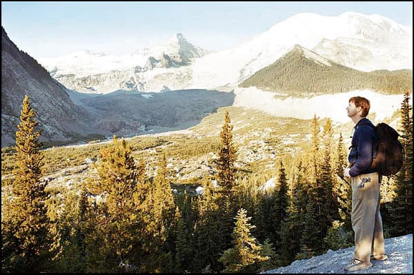
Mount Rainier and the North Cascades
Washington State's Mount Rainier National Park is a rugged landscape of waterfalls, glaciers, and lakes. The upper slope of its highest peak, Mount Rainier, a 14,410-foot-high volcano in the Cascade mountain range, is covered with 26 glaciers and scores of snowfields. Together they total 35 square miles, making it the country's largest single-mountain ice mass outside of Alaska. And that holds true even in summer, when hikers find ample ammunition for snowball fights after only 20 minutes of climbing up any number of trails. A four-day, 600-mile-loop drive out of Seattle is the ideal way to take in Mount Rainier, along with its national park neighbor, North Cascades National Park; an Old West mining town that's working hard to preserve its history; a bustling lake resort; and a curious village with Bavarian aspirations. Day one: Seattle to Winthrop The drive got under way inauspiciously as my wife, Sandy, and I negotiated the traffic on I-5/I-405 north out of Seattle's urban clutter. But as soon as we exited east onto the North Cascades Highway (State Route 20), the road opened up, and a seemingly impenetrable wall of soaring peaks loomed ahead. The Cascade mountain range is a 700-mile-long chain stretching from northern California into British Columbia. Within it, North Cascades National Park has the sheerest, most rugged peaks. More than a dozen soar above 8,000 feet; even the most experienced hikers can find them intimidating. Drenched by Pacific storms, the western slopes are covered in a dense, eerily dark forest dripping with moss. And on the high cliffs, hundreds of waterfalls cascade down--which is how the range got its name. We stopped briefly in Newhalem, where the National Park Service operates a visitor center, and picked up a free guide to day hikes. A mile beyond, we entered a misty forest on the gentle Trail of the Cedars. Following the racing Skagit River, the path makes a short loop among giant Douglas firs and western red cedars, which rival the California redwood for size and beauty. Signs along the way introduced us to the region's plants and trees; I started my informal education on how to tell the difference between firs and cedars. (Though both trees have reddish brown bark, cedars have scale-like leaves, while firs have needles.) After our hike, we picnicked at the trailhead, buying bread and a sharp cheddar at the Skagit General Store, which is right in the parking lot. East of Newhalem, the highway climbs through a spectacular gorge, edging high above a trio of slender lakes resembling the fjords of Norway. Gorge and Diablo lakes appeared bright green; Ross Lake, shimmering in the sun, reflected the deep blue of the sky. Checking our guidebook, we kept an eye out for the trail to Rainy Lake. The trail is just a mile long (one way), and it leads to what we agreed was one of the prettiest views in the Cascades. The path plunges into a forest of spruce, fir, and mountain hemlock. We crossed two bridged streams that splash down the mountainside. Then we found a place where suddenly the trees give way to a small turquoise lake, with evergreens lining the shore and a wall of rock towering above. Three thread-like waterfalls pour down. The road reaches its highest point at Washington Pass, at 5,477 feet. From a viewing area, we spotted climbers inching up 7,740-foot Liberty Bell, a massive rock that resembles the Philadelphia landmark. A ranger next to us watched the climbers' slow progress through her telescope. The highway descends gradually through a winding canyon to the town of Winthrop, on the sunnier, drier eastern foothills of the Cascades. The old mining outpost has worked vigorously to preserve its frontier look. Balconies hang over wooden sidewalks, creating a main street that looks like it could be a Gunsmoke set. Old Schoolhouse Brewery now occupies the town's little red schoolhouse--a fake frontier structure that was actually built in the 1970s--and serves the award-winning Ruud Awakening. In addition to refurbishing some old buildings, the town also built new ones in an Old West style. In search of a decidedly more authentic experience, we walked a block off the main road, Riverside Avenue, to the multibuilding Shafer Museum. The weathered collection of historical structures outlines the town's mining past. At the end of Riverside Avenue, the new 29-room Hotel Rio Vista lived up to its name; our room had a terrific view of the Methow River. For dinner, we took a two-minute walk down the street to the Riverside Grill, where I had a generous platter of excellent barbecued ribs. Day one Lodging Hotel Rio Vista 285 Riverside Ave., Winthrop, 800/398-0911, hotelriovista.com, from $60 Food Riverside Grill 162 Riverside Ave., Winthrop, 509/996-2444, barbecued rib platter $13 Old Schoolhouse Brewery 155 Riverside Ave., Winthrop, 509/996-3183, pint $3.50 Attractions Visitor Center, North Cascades National Park Newhalem, 206/386-4495, nps.gov/noca Day two: Winthrop to Yakima Before leaving town, we stopped in at the Winthrop National Fish Hatchery to learn about efforts to boost the number of chinook, steelhead, and coho salmon spawning in the waters here. The chinook and steelhead are officially listed as endangered species, and the coho is in even more serious trouble. Since the 1940s, the hatchery has been raising salmon, releasing almost 1 million youngsters annually on a 600-mile journey to the Pacific Ocean past nine dams, where the salmon live for an average of two to three years before returning to spawn. Annual returns number in the low hundreds. Due to the hatchery's efforts, the salmon are surviving, though certainly not thriving yet. This area has been plagued by summer forest fires, and the 66-year-old North Cascades Smokejumper Base, just outside downtown Winthrop, is the "birthplace of smoke jumping." Sandy relaxed in the room while I took a free 60-minute tour. An on-duty smoke jumper showed me the crew's parachute rigging room and led me aboard the two-engine plane waiting on the runway for the next fire call. Next up was Chelan, a busy resort town on a large lake. It was a little cold for a swim, so we enjoyed the views from the banks. Lake Chelan was carved by a glacier and cuts a thin swath into the heart of the Cascades. Passenger ferries cross the lake, which is 50 miles long, but we arrived too late to catch the 8:30 a.m. round trip on the Lady Express. For the next 40 miles to Wenatchee, U.S. 97 south runs along the Columbia River and the massive Lake Entiat, formed by a river dam. We stopped at one of the many roadside fruit stands to purchase a small box of golden Rainier cherries, fresh-picked and luscious, before briefly detouring west into the mountains to the curious little Bavarian-inspired village of Leavenworth. Taking a cue from their Alps-like setting, the local folk--who are not necessarily of German descent--decided to revitalize their once-failing community by creating an ersatz Bavarian village. Shopkeepers and restaurant crews are decked out in lederhosen. Yakima is an agriculturally rich city, noted in particular for its cherries, apples, and very good wines. It's possible to taste for free at 46 Yakima Valley wineries, many of which are clustered south of town. Day two Attractions Winthrop National Fish Hatchery Winthrop, 509/996-2424 North Cascades Smokejumper Base Winthrop, 509/997-2031 Lady Express Operated by Lake Chelan Boat Company, Chelan, 509/682-4584, ladyofthelake.com, 8:30 a.m. cruise $47 Yakima Valley wineries 800/258-7270, wineyakimavalley.com Day three: Yakima to Mount Rainier National Park We kept jackets and sweaters close at hand as we headed back to the high country. Even in midsummer, daytime temperatures can drop as low as 30 degrees, and lingering snowbanks line the road. On the way out of town, we stopped at a grocery store and picked up cheese, crackers, cherries, and cookies and packed them in a cooler in the car. Our winding ascent began just outside Yakima. Initially we passed through the slender canyon of the Naches River, and then at Chinook Pass (elevation 5,432 feet), we entered Mount Rainier National Park. At the first sight of snow, Sandy and I pulled off the road to toss snowballs, each of us scoring a direct hit. Though it's not America's highest peak, Rainier is the most awesome I've ever seen, because of both its massive bulk and easy accessibility. You can drive almost up to the edge of some of the glaciers. Practically filling the sky, the mountain towers in solitary glory above neighboring Cascade peaks like the statuesque ruler of a mystical ice kingdom. Our first stop in the park, requiring a round-trip detour of 40 miles, was Sunrise, which, at 6,400 feet, is the highest point reachable by car. We got a close-up view of Emmons, the largest (at 4.3 square miles) of Rainier's 26 glaciers, before stopping to pull out our cooler contents and picnic along the White River. It has its name for a reason: It appears white in color, a result of the silt--crushed rock called "glacial flour"--that is carried by glacial melt. Doubling back, we headed west to Paradise, which is the park's hub. The mini-village has a visitor center, a restaurant, trailheads to the summit, and a climbing school. Rainier's last major eruption was more than 500 years ago, but it could spout off again at any time. There are signs pointing the way to evacuation routes in the park, should you be on hand for the next eruption. Needless to say, I found the warnings a bit unnerving. The best way to view Rainier, a ranger told us, is to hike one of the well-marked trails at the edge of Nisqually Glacier. A low portion of the Skyline Trail led us through fields thick with wildflowers. A side trail took us up to a point where snow started. Not too far past that, the snow was so high it blocked our path, and we were forced to return to the original trail. That night, we stayed in Paradise, at the Paradise Inn. Built in 1917, it's a handsome wooden structure. In the grand lobby, the furniture is made of hand-hewn cedar. And upstairs, the rooms are tiny; a double bed all but fills one, leaving space for only a nightstand and--if you're lucky enough to get one of the bigger rooms--a chair and desk. But rates are reasonable, and the views in every direction qualify as luxury-class. It's the best place to stay in the park, and for that reason, it tends to book up months in advance. Day three Lodging Paradise Inn Paradise, Mount Rainier National Park, 360/569-2275, guestservices.com/rainier, from $92 Food Paradise Inn Dining Room bourbon buffalo meat loaf, $15.50 Attractions Mount Rainier National Park 360/569-2211, nps.gov/mora, $10 per car, valid for one week On our way out of the park, we stopped at Narada Falls. The magnificent waterfall spills over a cliff's edge in a roar and hits a huge rock; the water is then dispersed, spreading wide in a flow that seems as delicate as a Spanish fan. At the base of the falls, we picked up the 93-mile-long Wonderland Trail, which encircles Mount Rainier. We hiked for an hour and then turned around. But it led us into a quieter side of Rainier, with shadowy forests where the peace is broken only by the splashing of a stream. Before returning to Seattle, we caught a last glimpse of Rainier's glaciers out of the car's rear window. Just the memory of the ice seemed to keep us cooler for the rest of the summer. Finding your way At least five discount airlines serve Seattle-Tacoma International Airport: America West, American Trans Air, Southwest, Frontier, and JetBlue. You should be able to rent a car with unlimited mileage for under $140 a week. Keep in mind that snow in both North Cascades and Mount Rainier national parks can close parts of this route from November to May. If you go during any season other than summer, it's wise to check ahead about road conditions. Even in summer, on the western slopes of the Cascades you'll need a jacket, and it's possible that you'll also need a poncho or other rain gear. On the sunny eastern slopes, shorts and T-shirts should be sufficient. Temperatures reach 80 degrees. 1. Seattle Airport to Winthrop, 200 miles From the airport, take I-5/I-405 north to Route 20 east (North Cascades Highway) to Winthrop. Be sure to allow plenty of time for the drive; after leaving the interstates, the road becomes narrow and windy, and its edges are sheer drop-offs. 2. Winthrop to Yakima, 190 miles Take Route 20 south via Twisp to Route 153 south. At Pateros, continue south on U.S. 97, detouring four miles west into Leavenworth on U.S. 2. Return to U.S. 97 south to Ellensburg, picking up I-82 south into Yakima. 3. Yakima to Mount Rainier National Park (Paradise), 125 miles Take U.S. 12 west, picking up Route 410 into Mount Rainier National Park. Once in the park, detour north to get to Sunrise. To reach Paradise, you'll have to double back the way you came. 4. Paradise to Seattle airport, 95 miles Follow the park road to the Nisqually entrance. Pick up Route 706 west to Elbe, connecting to Route 7 and then to I-5 north. From the park, the drive to the airport should take about two and a half hours.