Everybody does the same thing when they come to New Mexico: They head north from Albuquerque, toward Santa Fe and Taos. But I went to school in a small town on the edge of the Navajo reservation up there, and my wife, Lynn, also once lived in that end of the state. We're more fascinated with what lies to the south, where Billy the Kid ran wild and aliens crashed.
So let's discuss the south of the state, or if you like, the north. When you're traveling to New Mexico, it's all good.
Ed answered your questions about New Mexico on Tuesday, February 1, 2005 at 12pm EST.
Ed Readicker-Henderson figured out how to live the retired lifestyle at a very young age: winter in the desert Southwest, summer in Alaska. Over the past 15 years, his travel articles have appeared magazines on five continents (Antarctica is still particularly frustrating him, as not many penguins seem to read); he's also the author of eleven books, with five more on the way. It was the fifth of these, on America's home-grown shrines, the sacred places of our common culture, that kicked off work on this New Mexico article. Where else can you find aliens, Smokey Bear, and a half million bats flying into the desert night? _______________________
Ed Readicker-Henderson: Hi, and welcome. Thanks for stopping in for this discussion about traveling in New Mexico, especially the much overlooked southern end of the state. I'll be here answering questions for the next hour, so if there's something you're dying to know, let me know, and let's see what we can come up with.
_______________________
Kansas City, KS: My buddy and I were planning to take a trip to go camping in New Mexico. What types of things should we look out for while out in the wilderness?
Ed Readicker-Henderson: We're going to hit this point a couple times over the next hour--New Mexico has one of the most diverse landscapes of any state in the country. What you're going to encounter, as far as weather, conditions, alerts, is going to change with where you are. Go in the desert, you'll want to take snake precautions if you're hiking in summer; you'll also need to keep a close eye on your water supply, as dehydration is always a factor. Go into the mountains, though, and you'll be facing entirely different conditions; rather than snake precautions, you might want to take bear precautions (don't cook in the tent, try very hard not to smell like food, make some noise while you hike). Either way, there's so much wilderness in New Mexico that you have infinite choice. The main thing is go prepared for the climate, and keep a sharp eye out. Know how to navigate--yeah, GPS is fun, but my Boy Scout training insists on always having a topo map and a compass along for good measure--and always, always, always let somebody else know where you're going and when you expect to be back.
_______________________
Moline, IL: I enjoyed your article as I am from Southern New Mexico. I think you missed out on some great stuff though. From Las Cruces you should have gotten off at the Hatch exit. That is where the best red and green chile comes from. From there travel towards Deming, which is 35 miles from Palomas, Mexico and Colubus, New Mexico. That was the site of the Pancho Villa raid. Further north through Silver City you would find the Gila Forest and taken the catwalk that is very impressive. Thanks for reviewing what I consider one of the most neglected part of that Wonderful State.
Ed Readicker-Henderson: This is a wonderful question/comment--thanks for posting it. To roughly paraphrase Mark Twain, "you can't have everything--where would you put it?" And that's what happened to Hatch; this is such an unknown part of the state to most people, I simply couldn't fit in everything I wanted to. For those of you joining us, yes, go to Hatch. Lovely area, great history, great food.
And while we're here, a couple other things that I didn't get to include in the article, but are well worth looking out for: when you're in the neighborhood of Capitan, Ruidoso is famous for its horses, its arts, and its hiking. Nearby is the Three Rivers Petroglyph National Recreation Site, well worth the stop. If you have time while you're heading up I-25 and are of a scientific bent, it's worth the sidetrip to head to the National Radio Astronomy VLA Telescope. If the people back in Roswell are right, and we're not alone, this is where we're going to be picking up the messages to prove it.
A couple other quick hits: all the farmers' stands around Alamagordo; the nut farms outside Las Cruces; the great mountain town of Silver City; and, if you turn right onto 380, instead of left, as we do in the article, you end up on the far side of the Trinity Site, which utterly fascinated me as being about as much middle of nowhere as it is humanly possible to be in the continental United States.
The article is a jumping off point. There is more good stuff here than most people can manage in a dozen vacations.
_______________________
Austin, TX: Isn't Cloudcroft one of the most beautiful towns, not only in the state of New Mexico, but in the country?
Ed Readicker-Henderson: And yes, to continue with the above discussion, Cloudcroft is gorgeous, as is the drive to the east of it--through long, narrow river valleys, full of horses. It's pretty amazing to be in the low deserts around Alamagordo, and only a very short time later be in the high mountains, wondering where in the car you stuffed your coat.
_______________________
Westampton, NJ: What part of the state has the best overall climate?
Ed Readicker-Henderson: And let's continue with the idea of Cloudcroft and climate here for a minute. As I've said, New Mexico's landscape is astonishingly diverse. The coldest I've ever been was walking to school, when I lived in Gallup, and the outside temperature was minus 47. The sandwich in my pocket was frozen by the time I got to class. On the other hand, summers in the desert can be . . . well, toasty. There's a certain interest to being outside in the sunshine when it's over a hundred degrees out. Everybody should try it once. The great thing about New Mexico, is that you can switch from one climate to another in an instant. There are so many high mountain towns, that you can get from the desert to the forest faster than you can drive to the grocery store back home. In summer, expect the deserts to be hot. Really hot. 90 degrees is a nice day, a hundred is not going to be that unusual. But on the same day, go up to 6,000 feet or so in the mountains, and it will be gloriously cool. And if you want to travel in the winter, it works the exact opposite way: spend the day skiing in the mountains, move down in the afternoon for a desert sunset and a chance to warm up.
_______________________
Pinetops, NC: Ed, I've enjoyed 2 trips to NM thus far and hope to return again. Can you explain in simple terms what caused the monolith Shiprock to form? Thanks.
Ed Readicker-Henderson: Shiprock, for those not familiar with it, is a massive rock formation in the northwest corner of the state, on the Navajo reservation. The Navajos long considered the rock sacred, and although it was always used as a landmark--you can see the thing from more than a hundred miles away--they stayed off it. It wasn't until seventy years or so ago that anybody actually climbed the thing.
Two possibilities of how it was formed. According to the Navajos, who have lived with it the longest, the formation is the result of a battle between Monster Slayer and two gigantic birds that were not behaving themselves. That explains nicely the wing formations on the rock. In Navajo, the rock is called Tse bi t'a'i, with a few accent marks this program doesn't allow. The scientific, considerably less poetic explanation is that Shiprock is the world's best example of a volcanic neck. It's about 1700 feet of lava pillar, and the landscape around it has simply eroded away, leaving the hard stone behind. For those who haven't seen Shiprock, or at least a picture of it, think of the famous Western movies shots of Monument Valley-th--se huge rock formations rising up out of the flat desert.
Now take one of the biggest ones, and move it out all by itself. It's a dramatic sight, and most geologists put it high on their list of places they have to see in their lives.
There's also a nice small town near the rock, with all services. When I was a kid, their church softball team usually creamed my church softball team.
_______________________
Orem, UT: I've heard that New Mexico has a rather large hot air balloon festival every year. Is it really all it's cracked up to be? Are there family activities?
Ed Readicker-Henderson: Albuquerque has one of the most famous balloon festivals anywhere; and you don't have to come just during the festival. Because of the climate, you stand a fairly good chance of seeing balloons at any time of the year.
The festival was first held in 1972, as a publicity stunt for a local radio station. Now, thirty years on, it's the biggest thing in the state. It's held the first two weekends of October, spread out over the four days. It's now considered the most-photographed annual event in the world, and in a good year, you can get a thousand balloons and who knows how many people there to watch them. To best see the balloons, you need to get up early and head out to the festival park. Balloonists like to catch the first rays of the sun, but it is something to watch, when a mass of balloons heads up into the impossibly huge New Mexico sky, all together.
Balloons tend to move east with the prevailing winds, over to the Sandias, where they can pick up a western blowing wind, and end up pretty close to where they took off. This nice little loop trail in the sky has made Albuquerque a favored spot for balloonists, who come from all over the world. If you didn't get up early in the morning, come back in the evening for the balloon glow: all the colored envelopes of the balloons lit up against the dark sky. There's also a "special shapes" event, which lets people try out less traditional shapes of balloons, like the Macy Thanksgiving Parade without the lines.
All day long, there's something for the family going on. Your kids will remember this forever.
The one thing that has to be kept in mind is that this is the biggest thing in New Mexico; book early. Very early, for both your hotel and your rental car.
_______________________
Texas: We also can't forget White Sands, one of the most beautiful places to visit. As you're driving in and see the bushes poking through the sand, you could have no idea that just a few miles down the road, the bushes will have disappeared and the sand will have taken over everything. Where else can you play on miles and miles of beautiful white beaches without getting wet? If you are in the southern part of the state, this is a must-see locale!
Ed Readicker-Henderson: Absolutely. My wife and I just stood in White Sands and tried to figure out why we loved it so much. It's . . . well, white sand. Lots of it. But when you're there, surrounded by the color and the blue sky above--or come at night to catch the moonglow--it is simply a magic location. And no matter how hot the day is, the sand is always comfortably cool. Really, this is one no one should miss.
_______________________
Mountain View, CA: We are planning to make 3 day road trip from Albuquerque to White Sands. We don't want to take Highway 25 twice. What alternative route you would recommend to take from Alamogordo to Santa Fe? We can spend two days on the road.
Ed Readicker-Henderson: You have a couple options for this. The easy, quick way is simply to head north on 54, which is a large, major road. You will be driving through some amazing emptiness here, sage brush and distant mountains. Really quite beautiful. Going that way, you pick up with the route we took in the article where 54 meets 380, and you could easily make it to Santa Fe in a day. A rather more unusual option is to head west, and take a huge loop route. From Las Cruces to Deming, then up to Silver City, and then through the Gila National Forest. Get onto highway 36, which takes you to Gallup, and that's one day. The next day, Gallup to Albuquerque to Santa Fe, which allows you time to stop at a couple of the pueblos, walk on the lava fields near Grants, and balance on the continental divide. This is a route for scenery lovers, because you really won't get a whole lot in the way of town action along the way. Either one of these keeps you from having to repeat the interstate; one gets you north faster, so that, depending on your vacation time, you'd have a little extra for some of the sites around Santa Fe.
_______________________
Austin, TX: How detrimental to tourism do you think the proposed coal bed methane drilling operations in the Valle Vidal will be? That is such a beautiful area; it would be a shame to see it despoiled with pipelines, roads, etc.
Ed Readicker-Henderson: A hard question, and one we always have to ask ourselves. In the corner of the state I lived in, up around Gallup, there were all the uranium mines. The truth is, no matter where we go at this point in our history, somebody is going to be drilling or digging for something.
What we've come down to is that you have to appear at the hearing meetings, and argue--if not for invisibility and and care-at least for best possible science. It's a balancing act, between conservation and economics, and the simple truth is, we need both.
The ecological problem here is that this area is important to elk calving, and there's a species of trout that simply doesn't appear anywhere else. Make yourself heard. If they go through with it-an-- in the current world climate, you have to think they will--at- east try and make them be careful. And keep an eye on them.
_______________________
Eugene, OR: Outside the Taos area, what are your thoughts on places to visit in the northern half of the state? I am originally from a small town between Taos and Red River and want to know that you have found as great things to see and visit other than the touristy towns of Taos and Red River? Thanks.
Ed Readicker-Henderson: I have to tout for one of my favorite spots in New Mexico here, the tiny town of Chimayo. There's not a lot to Chimayo, which is about 45 minutes or so northeast of Santa Fe, but it's one of the most important towns in the state, simply because of the church. Over a million people a year come to the chapel, because there's a small pit of dirt inside, and dirt from the pit is supposed to cure anything. Anything at all.
At Easter, people walk from Santa Fe to Chimayo, many of them carrying large crosses with them.
At any time of year, it's a beautiful spot--and even at Easter, it doesn't feel particularly crowded. It's in a little river valley, there's a street of adobe buildings that look like they were left over from some 1940s travel film, and the whole place just gives off an atmosphere of surprised contentment. It's one of those places you stumble onto, and that stays in your mind forever as one of your favorite spots.
_______________________
Columbia, SC: I am thinking about taking the 4-day road trip you mention in the article. How safe is it for single female to travel alone in New Mexico? Anything to be wary of or areas to stay away from?
Ed Readicker-Henderson: Most of the route goes through small town America, people who lost the keys to their houses ten years ago and haven't gotten around to looking for them yet.
That said, there are also some big cities on the route, a major interstate, and a couple places where the number of people coming and going behooves you to take standard precautions.
This is, in a way, a hard question for me to answer, because I'm fairly large and it's pretty hard to make me feel unsafe, simply because of my size. My wife, though, is short and blonde, so I defer to her on this question. I tend to think that if you're watching out, paying attention, you're not going to run into any problems. My wife and I have traveled this area a number of times, and I've never felt uncomfortable if she's wanted to go out on her own. She's in the background now, saying "You always want to keep your head up and your wits about you," but that to her, New Mexico has always felt like a very relaxed place.
Pay attention. If it feels wrong, go somewhere else. But don't deny yourself the beauty of the state.
_______________________
Clearfield, UT: I'm moving to Clovis, NM. What can I expect?
Ed Readicker-Henderson: Clovis is an old railroad and ranching town, and it still has a lot of that feel to it. The town's claim to fame is that it's where Buddy Holly recorded "Peggy Sue," and where Roy Orbison did some of his early work. All this gets celebrated at the annual music festival, held each July. One other little point of interest, is that there is a nearby archaeological site, Black Water Draw, where they found the remains of mammoth hunters--the desert Southwest was once a great place to be a mammoth.
As for the town itself, we're talking small town New Mexico. You'll be somewhat isolated, with plenty of wide open spaces around to enjoy.
_______________________
Philadelphia, PA: We are planning a trip to New Mexico and are torn about the time of year to visit. We want to see ABQ as well as go into Santa Fe and Taos. Our options are the end of March or the summer months. What are your thoughts?
Ed Readicker-Henderson: End of March can be very beautiful. I was up in the northern part of the state two years ago at that time, and we did have some interesting weather--a little snow, a lot of sunshine--so take some layers of clothes, just to be on the safe side.
If you're heading north, even summer isn't that hot, though, because you're up in the high mountains. There's also more to do in the summer, as the pueblos hold many of their ceremonial dances in the summer, when they can best get people in to watch them; also, summer is simply more geared up for the traveler, with summer markets and festivals.
On the other hand, depending on what the rest of the winter is like, there's probably still going to be good skiing to the north.
_______________________
Wylie, TX: My husband and I are going to spend the weekend before Valentine's Day in Albuquerque. We will be doing the requisite ski thing, but other than that, what are the 'must-sees' for a short trip?
Ed Readicker-Henderson: How short is your trip, and how much of it are you going to spend on the slopes?
A few really interesting things right around Albuquerque: you can make a day trip to Santa Fe, and check out the oldest still used church in the United States, as well as some great colonial architecture. You can go west, and take a look at Laguna or Acoma pueblos.
Just staying in town, there's the Old Town, well worth spending some time. There's a winery district, which most people don't expect, just north of Old Town, and also a bird reserve, the Rio Grande Nature Center State Park, which, at that time of year, may or may not have a whole lot to see, depending on who's migrating through and who's sticking around. Also some cool museums in Albuquerque, including a rattlesnake museum and the National Atomic Museum, where you can see replicas of Little Boy and Fat Man, and marvel at the innocence of a time when they thought they could just build a great big box to keep the blast in.
_______________________
Middletown, NJ: What about kids? What is there to do in New Mexico for kids ages 7-13?
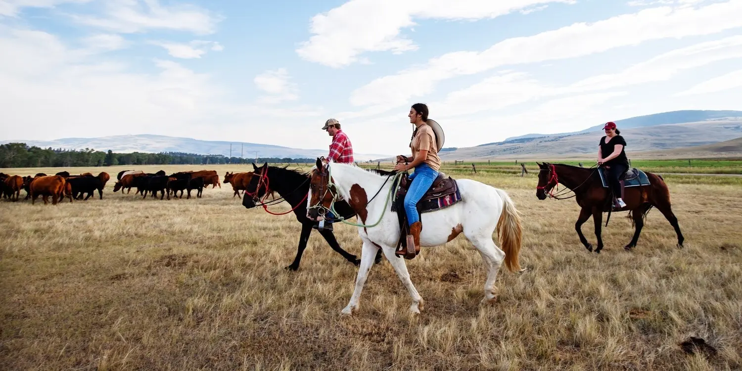
Ed Readicker-Henderson: Well, when my wife and I were both kids in New Mexico, we spent a lot of time in the desert hiking; and when we were done with that, we went hiking in the forest. If your kids aren't outdoor types, you might run into a little trouble, because this is a state where you want to spend your time outside. Lots of history in Santa Fe, as we all know. At the other end of the state, the Smokey Bear Museum is something all kids should see. There are plenty of places to go horseback riding.
And I wish, I wish, I wish my parents had taken me to Carlsbad Caverns when I was little. Watching the bats come out on a summer night is one of the most magical things I have ever seen in my life; I can't imagine the awe I would have felt if I'd gotten to see that river of bats when I was younger. Much less had a chance to go sledding at White Sands.
_______________________
Anthem, AZ: We love the New Mexico Adventure south from Albuquerque...but we are wondering about the safety of the route...and best times to see any wildflowers...if there are any to be seen.
Ed Readicker-Henderson: This should be an amazing year for wildflowers; after way too many dry years, the Southwest is finally getting some rain. But you're in Anthem--you already know that.
As for safety of the route, as I said before on the question about women traveling alone, this just shouldn't be a place where you need to worry. Small town America. Take normal precautions, don't let worry ruin your trip.
_______________________
Ed Readicker-Henderson: Thank you all for stopping in. I'm sorry I couldn't get to everybody's question, but I did at least try to touch on all the issues involved. I think you'll discover that New Mexico is one of the most overlooked states in the country. There is so much to see and do here, it's perfect for travelers of all types and all ages. You have to love wide open country, because you're going to see a lot of it, but you will be richly, richly rewarded.
Thanks for your time, and I wish you all a safe and happy journey.
_______________________