VERMONT ROUTE 100 Stamford, Vt. to Newport, Vt., 216 miles Snaking through the center of Vermont all the way from the Massachusetts border to Canada, Route 100 feels less like a state highway than one long, rambling backcountry path. A strict billboard ban preserves every vista as the road winds between the peaks of Green Mountain National Forest and passes through quaint valley towns like Hyde Park and Weston, population 631. With only farm stands, country stores, and covered bridges breaking up the landscape, you'll consistently feel 200 miles from the 21st century. Don't miss: The seven-mile stretch through Granville Gulf State Reservation, a favorite for leaf peepers, is also home to the multitiered, 35-foot Moss Glen Falls, which can be seen from the road. Trip tip: The Vermont Curiosities guidebook ($16) goes beyond foliage, introducing travelers to little-known gems around the state, from roadside barbecue joints to hole-in-the-wall museums.
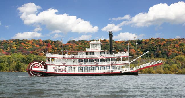
GREAT LAKES SEAWAY TRAIL Massena, N.Y. to West Springfield, Pa., 518 miles Consider this scenic waterfront byway an inland version of California's Route 1—minus the traffic. Among the highlights of the 500-plus-mile drive: the St. Lawrence Seaway's imposing Eisenhower Lock, the 28 historic lighthouses skirting the shores of the Niagara and St. Lawrence rivers, and Lakes Ontario and Erie, and the country's ultimate aquatic spectacle, Niagara Falls. Forty state parks along the way supply ample spots for camping, as well as opportunities for everything from bird-watching to shipwreck diving. Don't miss: Presque Isle State Park, a sandy, 3,200-acre peninsula near Erie, Pa., has miles of untouched beaches to explore. Trip tip: Ditch the tired car games in favor of the Seaway Trail's new geocaching trail: a high-tech treasure hunt where you use a GPS unit to locate natural and historic landmarks. Supplies are available at the Seaway Trail Discovery Center's online gift shop.
BLUE RIDGE PARKWAY Waynesboro, Va. to Cherokee, N.C., 469 miles One of the New Deal's most ambitious endeavors, this curvaceous "park to park highway" links Virginia's Shenandoah National Park with North Carolina's Great Smoky Mountains via dozens of hairpin turns and 26 tunnels cut through Appalachian granite. Spot a 19th-century farm or postage-stamp-size town at the bottom of a verdant mountainside and you'll realize how seemingly unchanged the road remains since its inception in 1935. Don't Miss: Concerts of traditional Appalachian banjo and fiddle music start at 10 a.m. Sunday through Thursday at the Blue Ridge Music Center, located in Galax, Va. Trip Tip: Banjo music is the ideal soundtrack for this drive. Get in the mood with Drive Time: Blue Ridge Parkway($8), a CD compilation of Appalachian music with songs by Aaron Copland and John Williams.
FLORIDA'S OVERSEAS HIGHWAY Key Largo to Key West, 113 miles Spanning more than 100 miles of the Florida Bay, the Gulf of Mexico, and the Atlantic Ocean, this one-of-a-kind road is actually the largest segmented bridge in the world, crossing the water in 42 places as it hops across the 1,700 islands of the Florida Keys. At dozens of spots along the route, side streets let drivers tackle a stretch on foot or bicycle, or break for snorkeling through a shipwreck at San Pedro Underwater Archaeological Preserve State Park and sunbathing at Bahia Honda State Park. Don't miss: The Seven Mile Bridge—only a slight exaggeration, at 6.79 miles long—connects the Middle and Lower Keys and rises 65 feet above the water, high enough to gain unobstructed 360-degree visibility. Trip tip: Read Ernest Hemingway's To Have and Have Not, which is set in Key West; then visit the eccentric author's home, now a museum at the end of the highway.
HISTORIC ROUTE 66 Chicago to Los Angeles, 2,448 miles First immortalized by John Steinbeck in The Grapes of Wrath, this original mega-highway has long personified the American dream of escaping hard times and making it big out West. Although you won't find the 84-year-old road on maps anymore (it's been replaced by segments of the Interstate Highway System), you can still follow the classic drive from the small towns of the Midwest and Great Plains through the deserts of the Southwest and on to Los Angeles. Don't miss: The 400-mile-long Oklahoma portion best embodies the retro spirit most 66 travelers are looking for, with ghost towns like Texola and Americana-rich sights such as the 66-foot-tall soda bottle marking Pops restaurant in Arcadia. Trip tip: Find (and stay on) the historic route with Here It Is! Route 66 The Map Series (historic66.com, $12), eight foldout maps with full driving directions and recommendations for the most worthwhile stops.
MONUMENT VALLEY Kayenta, Ariz. to Mexican Hat, Utah, 43 miles Nothing about dusty U.S. 163 in northeastern Arizona prepares you for the otherworldly structures that rise out of the desert floor just a few miles north of Kayenta. Along the Utah/Arizona border, Monument Valley is a dreamlike panorama of giant red mesas, sandstone buttes, and freestanding rock formations soaring as high as 1,000 feet. When the highway leads north into Utah, the earth seems to invert, and the towering red rocks give way to the ancient, deep-set canyons carved by the San Juan River. The drive is short, but it might take you hours, thanks to the sheer number of compelling photo ops. Don't miss: The 17-mile dirt road looping through Monument Valley Navajo Tribal Park is postcard-perfect, especially when the sun sets over natural rock statues like the 450-foot Totem Pole spire and the rounded pinnacle known as The Thumb. Trip tip: It's nearly impossible to watch any of the seven westerns director John Ford filmed in Monument Valley—including Stagecoach, The Searchers, and Fort Apache—and not want to see this environment firsthand.
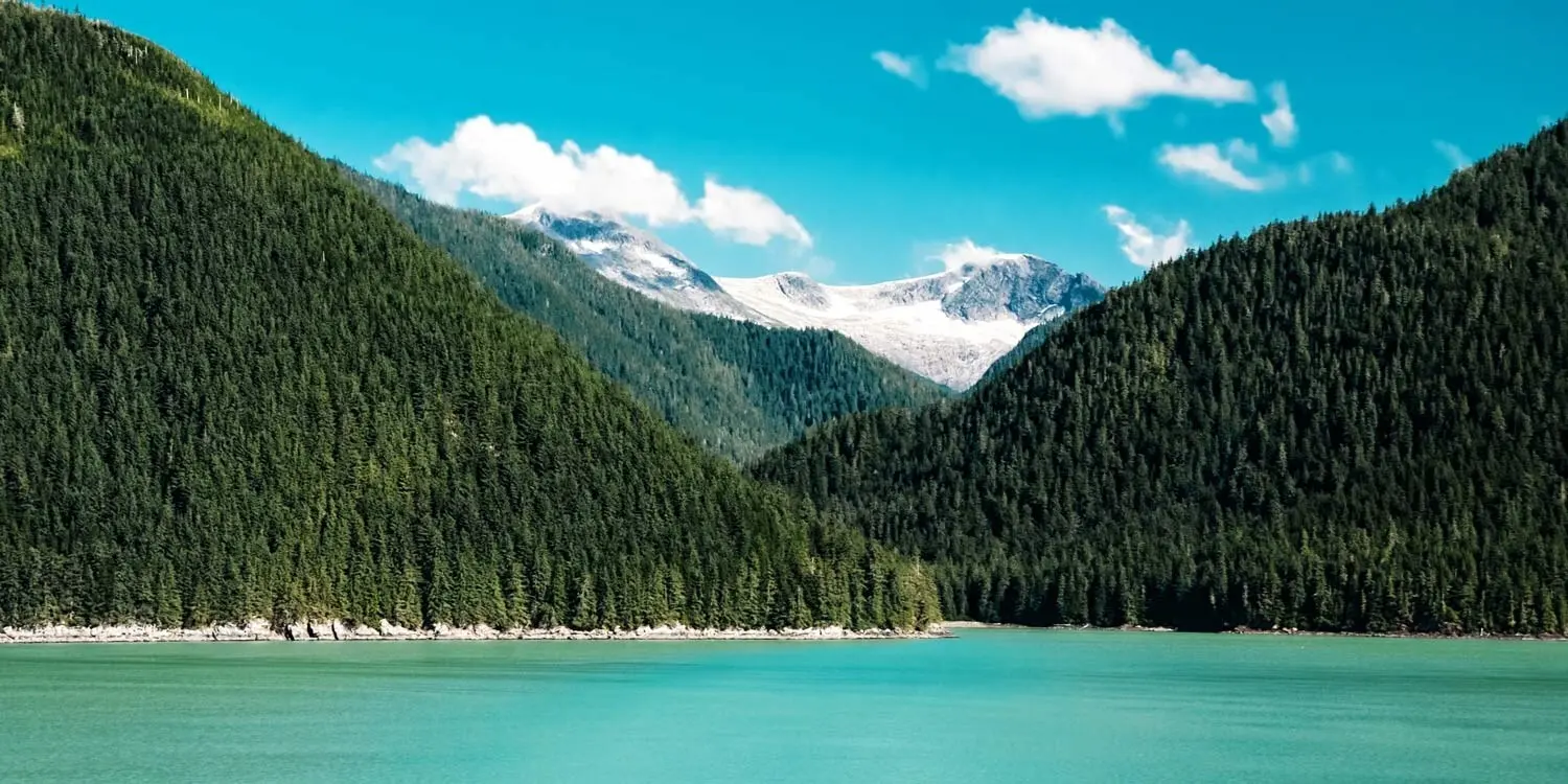
GOING-TO-THE-SUN ROAD Glacier National Park, Mont., 50 miles Here's one case where the name of the route actually does justice to its grandeur. The only drivable passage through Glacier National Park, Going-to-the-Sun Road has segments that hug the side of the Rocky Mountains, providing jaw-dropping views of the park's dense cedar forests, glacial lakes, and, of course, slowly diminishing glaciers: Only 25 glacial fields (ones larger than 25 acres) remain, a sixth of what existed in 1850. Sightings of wildlife like grizzly bears, bald eagles, and moose are common; drive slowly to (safely) take it all in. Don't Miss: At Logan Pass, elevation 6,446 feet, you can hike even higher into the mountains, where some of the crags stay snowy all summer. Trip Tip: Rent and watch the opening scene of The Shining; the overhead driving shots show Jack Nicholson and family navigating Going-to-the-Sun Road's dramatic twists and turns.
MOUNT EVANS SCENIC BYWAY Idaho Springs, Colo. to Mount Evans Summit, Colo., 28 miles This drive is all about superlatives: In addition to being the shortest trip to make our list, it's also North America's highest paved road, inclining some 7,000 feet in less than 30 miles. And it also has one of the shortest driving seasons: Memorial Day to Labor Day, weather permitting, which, lucky for us, is the best time to take in its yellow wildflowers, bighorn sheep, and a dizzying survey of the Rocky Mountains and Continental Divide at the 14,230-foot summit. Don't miss: Five miles before the byway's end, pull over for a sky-high picnic along the glassy, glacier-fed lake at Summit Lake Park. Trip tip: The weather on the Alpine tundra can change quickly; you could see rain, snow, 80-degree sunshine, or all three—in one day. An all-weather jacket such as Marmot's lightweight Essence ($160) will serve you well—it's waterproof, nylon-lined, and has integrated cooling vents.
CALIFORNIA ROUTE 1 Orange County, Calif. to Mendocino County, Calif. 655 miles The Pacific Coast Highway shows off the country's widest range of wow-inducing waterfront scenery, from the pristine beaches of Malibu to the cliffs of Big Sur, over the Golden Gate Bridge, and through the colossal redwoods of Humboldt County. More than 400 miles of the route run within sight of the ocean; drive south-to-north if you want a little distance from the road's edge, or north-to-south to feel the sea spray on your skin. Don't miss: Destined to be replaced by a tunnel in 2011, the landslide-prone pass 500 feet above the ocean known as Devil's Slide is this year's biggest last-chance thrill for adventurous drivers across America. Trip tip: The California Coastal Access Guide is the Golden State road-tripper's bible, with full-color maps and abundant details on where to swim, camp, hike, fish, and pull over for the best ocean sunsets—nearly 900 public points in all.