Travel 101: How to Raft the Grand Canyon

By The Budget Travel Editors
April 25, 2017
The Colorado River​ running through the Grand Canyon.
Anton Foltin/Dreamstime
The Grand Canyon is undoubtedly majestic when viewed from the National Park’s popular South Rim or the more off-the-beaten path North Rim. But to truly enjoy its natural splendor, you’ll want to head straight down into its beating heart—the thrilling (and chilling) whitewater rapids of the Colorado River.

WHEN SHOULD I GO?

Thanks to its desert location and dramatic changes in elevation, Grand Canyon National Park is a veritable climate roller coaster, with recorded temperatures spanning from winter lows of -22ºF to summer highs of 120ºF. Amazingly, these shifts have no impact on water temperature: Because the Colorado River is dam-released from the bottom of the country’s second-largest man-made reservoir, Lake Powell, waters remain at or near a brisk 46ºF, even during the blazing summers. While you’re welcome to raft year-round, keep in mind that each season offers a markedly different experience. May through September is the most crowded, when the summer sun offers a welcome respite from the chilling rapids. But consider the less crowded months of April and October, when you’ll practically have the river (and the limited campsites) all to yourself. Plus, spring and fall come with their own natural perks. April is peak wildflower season in the canyon, while October brings about the so-called “yellow” season, when golden plants all seem to miraculously blossom at the same time.

You might say rafting the Colorado River is like Choose Your Own Adventure: It’s an infinitely customizable trip that you can cater to your skill level, stamina, and schedule. The easiest option is a half-day, “smooth water” raft trip with Colorado River Discovery (raftthecanyon.com, from $87 plus $6 river-use fee). You’ll start at the base of the 700-foot-tall Glen Canyon Dam, near the town of Page, Ariz., and encounter no rapids along the way. The most hardcore trips, which require expertise and months to years of planning, are the 12- to 25-day self-guided journeys, which take rafters from Lee’s Ferry to Diamond Creek—a whopping 225 miles.

HOW EARLY SHOULD I START PLANNING?

Your planning schedule will all depend on the length of your trip and whether or not it’s professionally guided. For quick day tours, you can book online, often at the last minute. But most other options require months to years of planning. For overnight self-guided trips, you’ll need a permit from the National Park Service. Only two raft groups can disembark each day, so you should have a date in mind and pounce on the

slot when it becomes available a year in advance. Longer guided trips can be booked with one of the park’s approved tour outfitters, and many fill up two years early. Finally, if you’re hoping to set out on a large-scale, self-guided river trip (12 to 25 days), it’s all about luck: To receive a permit, you’ll need to enter a weighted lottery system (nps.gov/grca). Names are drawn and launch dates are assigned each February, but keep in mind that it can take years to have your name selected, so be open to other types of trips as a backup plan.

WHY SHOULD I CONSIDER A PROFESSIONAL OUTFITTER?

Unless you have experience with whitewater rafting, you’ll definitely want to use one of the National Park Service’s approved tour vendors. While the river may look peaceful from up above, it can actually be rather treacherous for amateurs. The most intense rapids—labeled either Class V on a standard river scale or size 10 on the Grand Canyon’s unique ranking system—can include enormous waves, steep drops, waterfalls, and extremely narrow passageways between dangerous cliffs. But it’s notjust safety that makes outfitters so great:

They also, quite simply, make planning infinitely easier. Most tour companies will provide rafts and oars (as well as auxiliary watercraft, such as kayaks and stand-up paddleboards), helmets and life jackets, sleeping accommodations (such as sleeping bags, mattress pads, or tents), food, and, perhaps most importantly, bathroom accommodations. In addition, tour operators will shuttle guests down to the river, which can often be an adventure in its own right for travelers going it alone.

WHAT ELSE WILL I DO ON THE TRIP?

The river may be the focus of your rafting adventure, but it’s also a fantastic delivery device, connecting the canyon’s many diverse activities. During layover days and meal breaks, you might find yourself rock climbing, bird watching, swimming along the banks, cliff jumping, searching for hidden waterfalls and grottoes, or touring ancient Anasazi granaries and dwellings. Rafting offers a serious upper-body workout, so consider a hike to get your legs moving. By heading into one of the many narrow limestone slot canyons and going up in elevation, you’ll find a totally different view of the river—an outstanding perspective on how far you’ve traveled and how much river is still left to conquer.

WHAT WILL I SEE ON THE JOURNEY?

  • Bald eagles spend winters along the Colorado River, stocking up on trout.
  • Bighorn sheep can be seen negotiating the steep cliffs leading down to the water.
  • Eight species of bats live in the desert uplands, but feed on bugs right along the river.
  • Arizona’s state mammal, the raccoon-like ringtail, is a nocturnal hunter, frequently seen scavenging around campsites.
  • The rare California condor can often be glimpsed circling on thermal wind currents high overhead.

WHAT SHOULD I PACK?

  • L.L. Bean Neoprene Paddling Gloves: The Colorado River remains at or near a chilly 46°F, even in the summer. Neoprene gloves are a lifesaver, and these come with a Sharkskin grip so you won’t drop your paddle (llbean.com).
  • Pelican iPhone Case: Professional photographers swear by Pelican’s heavy-duty camera cases, but you’ll love its water-resistant, crush-proof iPhone covers, which are O-ring sealed and include an attached carabiner (cabelas.com).
  • Outdoor Research Bug Bivy: River banks can be notoriously buggy, so campers swear by this affordable sleeping sack that comes complete with a protective layer of mosquito netting (rei.com).
Plan Your Next Getaway
Keep reading
Adventure

3 Gorgeous Places to See Spring Flowers

Spring is on the way, we promise! And we don’t just love the longer days and the warm sun. Some of the world's best travel destinations are hotspots for beautiful spring flowers. We're here to show you some of the most beautiful places to see the most colorful blooms. 1. AMSTERDAM Step into a Technicolor wonderland! Keukenhof Gardens, outside Amsterdam, is one of the world’s most spectacular flower gardens in April when the tulips are in bloom. Take a guided tour, or rent a bike to go exploring. Or if you really want to indulge, book one of Avalon Waterway’s Tulip Time river cruises. The Netherlands is tulip-crazy all spring long, and Budget Travel loves Amsterdam for museums filled with Van Goghs and Vermeers, its charming canals, and affordable lodging. 2. DEATH VALLEY, CALIFORNIA Sure, the name sounds bleak, but when winter rains water the California desert and the sun warms the land, wildflowers bloom in the spring. While not every year is categorized a “super-bloom” (a perfect storm of gentle rain, sun, and warm winds), it’s always a knockout, with Desert Gold, Evening Primrose, and Desert Dandelion putting on quite a show. 3. KAUAI, HAWAII It’s always prime time for flowers in Hawaii, but spring is affordable “shoulder season” here and the Hawaiian island of Kauai has a special treat: The new McBryde Gardens, part of the National Tropical Botanical Garden network, which premiered in 2017. You’ll see Bird of Paradise, Hibiscus, and the Banana Shrub, which actually smells like a banana daiquiri!

Adventure

See What Happened When This American Couple Visited Iran

This article was written by Audrey Scott and Daniel Noll and originally appeared on Yahoo Travel. Before we set off to Iran there was fear. Not so much from within us, but certainly from our family and friends, those usually unequivocal in their support of our travels. During our pre-trip round of phone calls the night before our departure, the tone of some of the goodbyes seemed to imply some thought it just might be for good. Such was the response to us, an American couple, going to Iran. With the recent nuclear deal, interest in travel to Iran is again on the rise. And with this, questions arise: “What did it feel like to travel in Iran as Americans? Is it safe? And why make the effort to visit Iran anyway?” Traveling in Iran as Americans: Our experience, it surprises people—we sometimes think they don’t believe us when we tell them that Iran was the country where we felt most like rock stars. Truly. From the markets of Tehran, to the mosques of Shiraz, even in the dining car of a train across northern Iran to Turkey, we—the Americans—were the unwitting stars of the show.  Iranians are a curious lot. When we revealed that we were American, their excitement level would rise noticeably. They wanted their photos taken with us, invited us for tea, and even showed us off to friends, as if to say, “Look what I found!” Others in our group, Europeans and Australians among them, were welcomed warmly, but their nationalities didn’t seem to carry quite the same draw. Honestly, we were flattered. And sometimes embarrassed by the attention. Take, for example, our visit to the covered bazaar in Shiraz with another American woman in our group. An old man asked us where we were from and what we were looking for at the bazaar: “We’re Americans and are just curious.We don’t have markets like this in our country,” we said. He asked us to wait. After a few minutes, he returned with gift boxes of Iranian cookies and sweets for us to take home to our families. We were barely able to leave the bazaar for all the invitations—to tea and to people’s homes—in the city and halfway across the country. Related: Hot Springs of Iran: the Next Spa Lover’s Fantasy Only later, after returning to our hotel and turning on the television, did we learn the irony of our day: It happened to be the anniversary of Iran’s taking of the American hostages in 1979. International news channels were filled with scenes of demonstrations flush with dancing “Death to America” posters and flaming American flags.   It reminded us of the repeated message from ordinary Iranians we’d met on the street: “People are people, governments are governments. Please tell your friends about the real Iran.” So why travel to Iran? The country is culturally rich and visual varied. From the stone-carved grandeur of 2,500-year old Persepolis, the capital of ancient Persia and the setting of the first verbal expression of universal human rights, to the dizzying bits of Islamic tile work in mosques throughout the country, the place is a formidable mountain of history. It’s no surprise that Iran boasts 19 UNESCO World Heritage sites, the most of any country in the Middle East. Then there are the covered bazaars, some of which are over 800 years old, where you can get lost in miles of alleys filled with spice piles and warrens clogged with old men haggling over the fiber count of locally woven carpets. Teahouses, where friends gather for conversation, sweet tea and hookah pipes filled with fruit tobacco, give a taste and glimpse of the social pulse. Related: Solo + Woman + Iran = Insane? Our Writer Did It At the moment, in order for Americans (as well as Canadian and U.K. citizens) to obtain an Iranian tourist visa, they must either book an organized tour or travel with an authorized private guide. During our trip to Iran, we did both—a small-group tour with tour company G Adventures followed by a one-week trip on our own with a local Iranian guide. Even if you are an ardent independent traveler as we both are, don’t let this requirement deter you. We enjoyed ample time on our own to explore and engage, so that we might come away with our own story of Iran and its people.  WATCH: Avalanches, Death Threats, and No Lifts. Welcome to the World’s Most Dangerous Ski Race

Adventure

Coast-to-Coast by Word of Mouth!

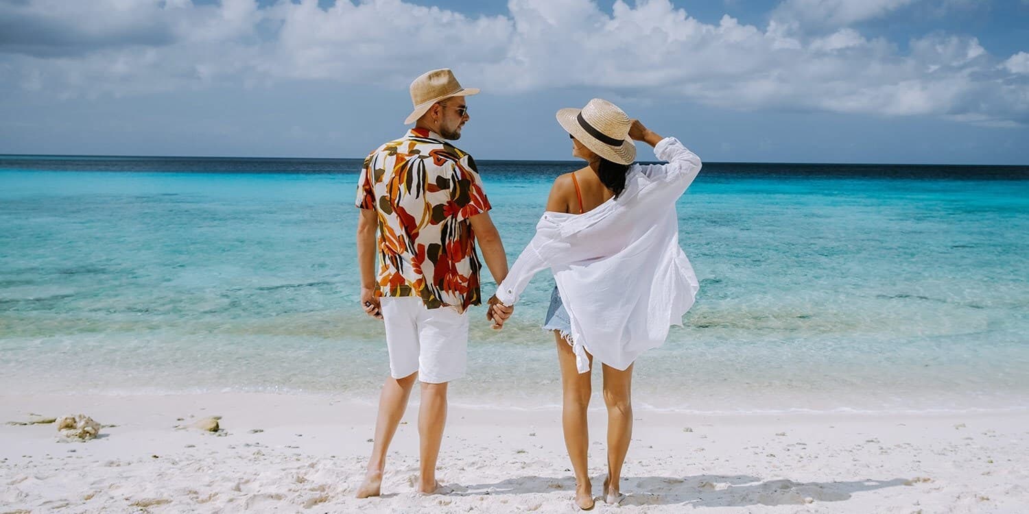
In our modern world, we’re more connected by technology than ever before, but I can’t help but feel that we’re actually growing further apart. Travel is all about connection—that sense of belonging. So I decided to seek out travel advice from the people I met on a solo road trip across the U.S. We start on the California Coast. You ready? See the photos from my coast to coast road trip!  Days 1–3: Los Angeles, CA to Yuma, AZ The scenic Pacific Coast Highway (Highway 1) just south of Los Angeles couldn’t have been a more inspiring start to my trip. Travel is a funny thing: No matter how seasoned you are, there’s nothing more encouraging than meeting an impossibly earnest person with a contagious spirit in the face of a long, unknown path ahead. Warm, lovely Allie Rose, working at a strawberry stand in Long Beach, reminded me why I decided to take this journey in the first place: I needed to look up from scrolling through my iPhone, put down my guidebook with its carefully dog-eared corners, and appreciate fleeting moments and enlightening people. I call them the “darlings” of the road, placed there seemingly on purpose. I bought two pints of ripe red strawberries from Allie for $4 before taking in the scene at Tamarack State Beach. So many cars were pulling over that I thought there must be a festival. Nope! The pre-sunset tides were so ideal that droves of surfers were racing to catch the perfect wave. I’m a surfer poseur, so after snapping shots of them suited up and expertly skimming the water, I sat on the beach and ate the fresh, sweet strawberries while looking out over the Pacific Ocean, at times seeing nothing but the heads of agile surfers bobbing up and down in the distance. As I dipped 24 miles south on the PCH, picturesque vignettes of the ocean kept appearing over my right shoulder, one after the other. I reached La Jolla Cove—famous for its hundreds of seals—just in time to catch the sunset. Daybreak at San Diego’s Sunset Cliffs Natural Park came dressed in a mellow haze of light fog—peaceful weather ideal for yoga at dawn. I was soon back on the road, on Route 5, in search of a dish true to the area. A local truck driver’s recommendation? Blue Water Seafood Market and Grill. Less than five bucks bought me a hearty mahi mahi taco and a fresh-outta-the-sea flavor I’ll spend my whole life trying to find again. 
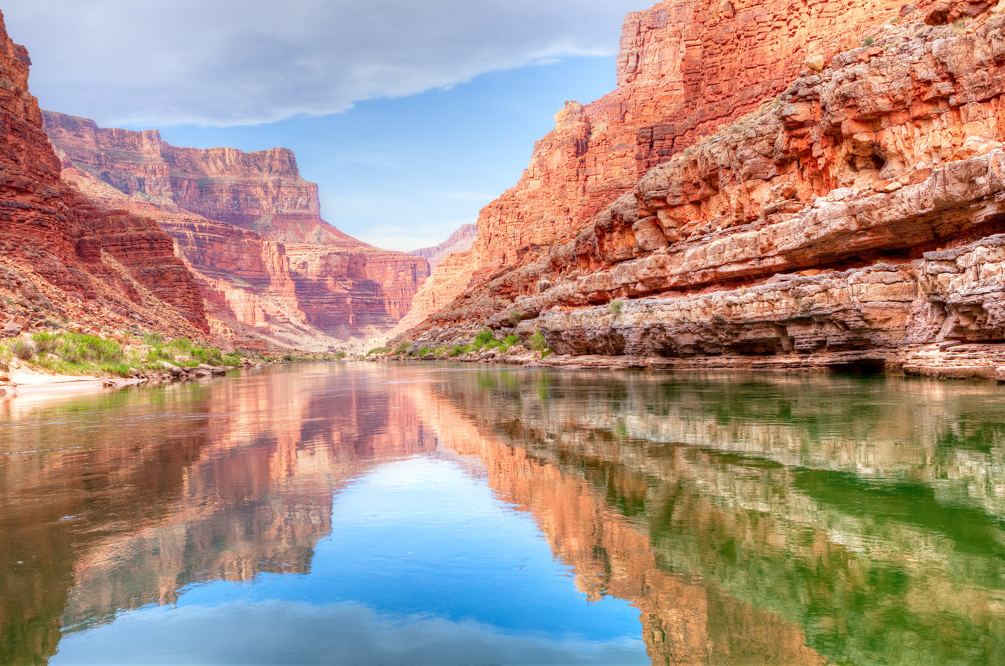
Turning onto I-8, I traced the Mexican border, weaving close to it, then skirting away when the highway leaned north. Coming from the coast, the ocean vistas twisted into a mountainous desert landscape, which transformed into hills seemingly made of tiny pebbles. The roadside flatlined into desert followed by fields. Just shy of Yuma, Arizona, the almost Moroccan-looking Algodones Dunes came into view, the sand’s curves resembling perfectly whipped chocolate meringue, the peaks folding into valleys again and again. Ten miles west of Yuma, I motored to Felicity, California, dubbed the Center of the World. The strange compound’s pyramid holds the “official” center-of-the-world plaque. A sun dial made of a bronze replica of God’s arm juts out from the ground, as does an original spiral staircase from the Eiffel Tower. I felt that pleasant disorientation that road tripping is all about. At Yuma Territorial Prison Museum, I met Louie, the kind of guy who refuses to take his sunglasses off for a portrait but will let you see into his big, open heart. As I left, he said, “Good luck on your trip. Don’t take any bullsh*t from anybody. If people try and tell you bullsh*t, just ignore them and go on your way. Keep holding true to your instincts.” Days 4–6: Tucson, AZ to El Paso, TX Green chiles and desert peaks: Check and double-check! The southwest, by way of southern Arizona, New Mexico, and West Texas, offered me spicy eats, cool drinks—and a pickup line that's so good you might want to write it down. After cruising past the unmistakable desert silhouette of Picacho Peak on I-10, I discovered my new favorite drink: kombucha on tap—literally pourable probiotics!—at “plant-based” (a.k.a. organic, locally sourced, and vegan-friendly) Food for Ascension Café in Tucson. While exploring the city center, I crossed paths more than once with a curious kid along East Congress Street. When we finally spoke. I thought I had just heard our generation’s latest pickup line (“You on Instagram?”), but it turned out he was a local filmmaker likely just interested in my heavy-duty camera and what I was shooting. A self-proclaimed Chuck Taylor sneaker enthusiast, José suggested I head to Fourth Avenue, a stretch of road saturated with hyper-local establishments and colorful characters, not technically downtown and not quite into University of Arizona territory. Fourth Avenue feels like it’s growing by the minute yet manages to maintain a humble, familiar energy—a nostalgia, even: the rare up-and-coming area that’s not trying too hard to be hip. Afterward, I hopped back on the road to Las Cruces, New Mexico, specifically the village of Mesilla. I’d gotten word that La Posta de Mesilla dishes out the “best green chiles in town,” so I pulled up a chair and ate next to a group of friendly folks who recommended I take Route 28 to El Paso. Reason being: It runs south through a string of pecan farms, with trees reaching out from either side of the road to form a gorgeous natural leafy archway that continues for miles and miles. Around the West Texas border, I noticed my “I’s” turning into “we’s.” My rented Prius (I’d named her Penn) and I had been through a lot: unexpectedly rugged terrain, shameless karaoke-worthy playlists, and eerie green skies in El Paso, where I feared flash floods and tornadoes that never appeared. Yes, I had formed a bond with an inanimate object. Penn was officially the Rocinante to my Don Quixote. My noble steed. Days 7–9: Marfa, TX to Lockhart, TX Take one nail-biting traffic stop and mix in wild animals and a barbeque joint, and you've got my first taste of the Lone Star State. Border police, if you're reading this, I vow never to mess with Texas again. Three hours southeast of El Paso, the artsy celebrity haunt Marfa, Texas, appeared like a mirage. I stumbled on the Food Shark Truck, where hipsters in combat boots, families, and in-the-know seniors were grabbing falafel sandwiches (“marfalafels”) and tacos. On advice from Laura in El Paso, I cruised to Big Bend Brewing Co. in Alpine, Texas, where I admired amber-hued ales and met hard-scrabble Randy. When I asked about his hat, he said, “A hat? This is a lid, kid. I was born with this thing on.” En route to San Antonio, I had my first—and only—run-in with the law. I had innocently taken a long-cut around Brackettville to avoid stirring up my fear of wind turbines (it’s a real thing called anemomenophobia!), which is a no-no: The route is often used by shady types to avoid the border patrol checkpoint on I-90. Two cops swiftly pulled me over. I told a very serious-looking officer about my windmill phobia, and they sent me on my way—after searching my car. The trouble was worth the beauty I saw next: five antelope with prominent spiral horns. After a stop at Pearl in San Antonio for some souvenir jewelry, this leg of my trip ended on a high note: Smitty’s Market in Lockhart, Texas. I eagerly dug into my pile of smokehouse meat served on butcher paper. Days 10–11: Austin, TX to Houston, TX I didn't have to look too hard to find exactly what keeps Austin weird (hint: peacocks and two-stepping play a major role) before heading east to Houston and eventually leaving my inner cowgirl behind. Next on the map? Austin. And the close wildlife encounters were just beginning: Back in Marfa, I received a true Keep Austin Weird–style suggestion to visit Mayfield Park, a “peacock park” that is not a zoo. The pretty beasts unfurled their plumage as I snapped them mid-mating dance. Later that night, I got my ultimate Texas experience at the Broken Spoke in Austin, a dance hall dubbed the “best honky-tonk in Texas,” where locals pay $12 to two-step to live music, sip beers, eat barbecued brisket and potato salad, and watch newcomers try their best to fit in. Soon after I arrived, an older amiable fellow in a cowboy hat, Levi’s, and leather boots named Polo, who says he comes every Saturday, introduced himself. He knew right away that I was a newbie—not because I was green to the scene, but because he seems to have met everyone who comes through the Spoke’s door. I was honored when he asked me to dance. That night, a legend was in the house: Dressed in a flashy red shirt studded with rhinestones, Broken Spoke founder James M. White made his way through the crowd, which treated him with deference and respect, as though he were a beloved local politician. A soothing punctuation mark to my Texas travelogue was a sunrise visit to artist James Turrell’s Twilight Epiphany Skyspace: a grass, concrete, stone, and steel structure with a rectangular window to the sky designed to function as a mind-bending play on color when the sun rises and sets. As I lay on the ground, I watched the colors of the sky change as the pavilion’s artificial light glowed around it, tricking the mind into thinking the sky is a different color than it is. You could call it an immersive, highbrow version of the “blue or white dress” debate. Visits are always free. Before I headed to Louisiana, I grabbed a bite in Houston at Local Foods, where Nina shared with me her favorite New Orleans staples from her days at Tulane, despite the long, long line of people waiting behind me: “When you are downtown, make sure to look at the antique shops on Royal Street and see some live music on Frenchman. New Orleans is my favorite city in the world... so far.” Days 12–13: New Orleans, LA to Tallahassee, FL A little-known beignet joint, a stroll down Frenchman Street, and a conversation with a New Orleanian who tried to beat me at my own game were all highlights of my journey through the Deep South. Swinging low from Baton Rouge to N’awlins and back up again to Slidell via I-10, I found myself deep in southern Louisiana. If you’ve been to NOLA, you probably know Cafe Du Monde’s beignets. Instead, on the advice of a photographer couple, I went north, toward Lake Ponchartrain, to Morning Call Coffee Stand, which serves beignets off the beaten track—and has fewer tourists waiting to steal your table. There, I met Robbie, exactly the kind of server you’d expect to find at a 24/7 coffee stand going on its 145th year of service in the south. Even though I only wanted to try one hand-rolled beignet, Robbie informed me, with an infectious grin and persuasive shrug, that I could get three for the same price. When I asked to take his portait, he said yes—but only if he could also take mine. Pretty clever, and a first on this trip! My beignets appeared on a white plate, plump and golden, a sugar shaker at the ready. After giving them a powdery coat, I bit into the first one. Bliss. Sugar State bliss. Days 14–15: Savannah, GA to Charleston, SC Is it over already? After two weeks of unique sights, good food, and unbeatable chats with locals, I pumped the brakes to settle into Georgia's slow southern pace, eventually winging my way up to South Carolina for one last sunset. Dusk in Savannah. As the sun melted like hot butter on the horizon, over the rooftop of my hotel, I plotted out my journey to the Olde Pink House for dinner the next day—the restaurant has a stellar reputation for shrimp and grits, specifically its “southern sushi,” smoked shrimp and grits rolled in coconut-crusted nori. Since my hotel was nearby, I stopped by to scout it out. While doing so, I met Jasmine, an effervescent young hostess who asked me if I would take her portrait—but quickly caught herself: “Tomorrow! Can you come back tomorrow? I’ll wear pink.” My second day in town, I hopscotched among Savannah’s 22 lush, grassy squares to iconic Forsyth Park, draped in the Spanish moss that's inseparable from the idea of Savannah as a city. After capturing the scene on camera and doing some serious people-watching and music- listening—musicians constantly play in the park—I meandered along the river, stopping at Savannah’s Candy Kitchen for a candy-dipped apple crisscrossed with ribbons of chocolate. One last state loomed large as I zoomed up I-17. Folly Beach, South Carolina, grabbed my attention with its classic Atlantic Coast vibe: locals eating ice cream, playing volleyball, and dipping their toes in the surf. I bellied up to the Folly Beach Crab Shack, ordered crab balls with rémoulade for less than 10 bucks, and set out for a marina between the beach and Charleston: the best place to watch the sun set, Bonnie at the crab shack shared. As the horizon shifted from orange to pink to navy, I let my mind drift back to the start of my trip, my thoughts running backward across the country, up and down the south’s peaks and valleys, past its ocean vistas, along the open road, accompanied by my camera, now filled with freeze-framed natural beauty and the faces of new friends.

Road TripsAdventure

For Daring Drivers Only: The World's Scariest Roads

This article was written by Greg Keraghosian and originally appeared on Yahoo Travel. Maybe someday, Doc Brown will be right. Maybe we won’t need roads. But until we all get a flying DeLorean, we’re going to be using them in our travels, and often they’re a big part of the fun. For some, that fun requires trying not to die when you’re driving said roads. If you just can’t feel satisfied without navigating hairpin turns, dizzying elevations, and gravel surfaces with no guardrails to protect you, we’ve got you covered with this bucket list of freaky routes. Some of these are highly traveled destination roads, some get very little traffic, and others are obscure to most drivers. But if you can patiently and carefully handle them in the proper vehicle, you’ll be rewarded with some tasty visual treats, plus access to unique mountain-climbing and cycling adventures. We’d tell you to buckle up, but we’re not sure how much that will help you here: Lippincott Mine Road, Death Valley National Park, Calif. This little-used 7-mile route in and out of the park near the famous Racetrack Playa really puts the “Death” in Death Valley. It’s a faster route to the park than others, but you might be clenching your jaw the whole way trying not to fall hundreds of feet to oblivion, and it’s not for the casual driver or the casual car. This is four-wheel drive territory only. My friend Doug did the honor of driving us out of Death Valley via Lippincott at the end of our camping trip last fall, and by the time we had slowly descended the almost-2,000-foot drop, I felt like the park had chewed us up and spat us out into Saline Valley. What could kill you here? Let us count the ways. There are no guardrails, and there is the constant threat of a steep fall if you’re not careful—at times, there’s just a foot or two of gravelly space to navigate. You’ll be driving around or over some large rocks that could break down your vehicle, and if that doesn’t do it, the park’s intense heat could if you’re making the uphill climb into Death Valley during the hotter months. There’s no towing service, no water source, no road signs, and no cell reception. Other than that, this drive is like Christmas. Still, competent drivers in the right vehicle can make this trip safely. Make sure you stop along the way to capture some gorgeous views of the valley below. Also, if you enter the park this way, you’re just three miles from the Racetrack and its otherworldly beauty. Just play some Metallica at full blast as we did in this video clip to give you the adrenaline rush you need to survive. Road of Death (North Yungas), Bolivia There’s nothing ironic about the name of this 38-mile journey that goes from over 15,000 feet in La Paz to 3,900 feet in Coroico—it is the black widow of roads. Its claim to fame is being named the world’s most dangerous road by the Inter-American Development Bank, and it’s estimated that 200 to 300 people traveling on it die each year. It’s not hard to see why the road is so dangerous: It’s barely the width of one vehicle, with no guardrail to protect you from falls of up to 2,000 feet. Rain can make the road muddy and slippery, and rain or fog can reduce a driver to feeling blindfolded. Still, there’s a siren song here that attracts thousands of people, from danger-loving tourists to hardcore cyclists. The view of the Amazonian rain forest is astounding, and standing right over the sheer drops here will bring out the lemming in many of us. Tour groups that serve the road include Barracuda Biking and Gravity Bolivia. Trollstigen Mountain Road, Norway As dangerous roads go, this is among the most visited in the world, and for good reason: It overlooks a UNESCO World Heritage Site, the Geirangerfjord on the west coast of Norway. I’d like to say that I gave death a noogie as I raced this road’s 11 hairpin turns and 9 percent incline in an Alfa Romeo, but in fact, I slowly weaved through it on a large tour bus. Next time, I swear. Dangerous conditions here include the incline, narrow driving space, and the poor traction and visibility that come with rain and fog. But oh man, those views: There are ideal photography opportunities where you can pull over and capture the fjords and lush valleys below, and waterfalls so close you can touch them. Note: The road closes in October and opens in May. Related: A-ha! The Ultimate All-Norwegian Playlist for Exploring Norway Road to Hana, Maui, Hawaii Paradise is worth the risk, which is why the 42 miles of Highway 360 to Hana in eastern Maui are such a tourist favorite. You’ll have to navigate through and around 600 hairpin turns, 54 one-lane bridges, steep cliff drops, falling rocks, and even some confusing mile markers that reset. Plus it rains often, so there’s that. But the rewards for your risk are considerable: You probably won’t have time for them all, in fact. The road itself is full of pull-over-right-now photography opportunities, but venture deeper and you’ll find such rare beauties as Wai’anapanapa State Park’s black sand beach, Twin Falls, Wailua Falls, and the laid-back charm of Paia Town. Drive slow and you’ll be fine here—you’d better, in fact, because police strictly enforce the 25 mph speed limit. Related: Life Lessons from Maui: What I Learned Driving the Crazy Road to Hana Dalton Highway, Alaska While the Road to Hana is seductively warm and dangerous, this frosty, gravelly, pothole-laden route is as seductive as a White Walker in Game of Thrones. The Dalton Highway was opened for one thing: transporting oil. And it covers 414 miles of desolate, icy terrain. This is the route of Ice Road Truckers fame, and you’ll have to excuse the truckers for thinking you’re crazy if you want to drive this highway for fun. Let’s put aside the freezing cold and often-miserable road conditions, with 18-wheelers pounding your vehicle with ice. On a single 240-mile stretch, there are no gas stations, restaurants, or basic services—the longest such stretch in North America. There are three—count em, three—gas stations the entire way. And don’t count on cell service at all. Still, there are enticements to taking your chances here. You can say you’ve crossed into the Arctic Circle, which the highway does. And if you visit at the right time, you can slowly pull over and watch the northern lights. A guide is highly recommended here unless you know your survival skills, as you’ll need to pack provisions, including gas. And be on the lookout for freeway closures, such as the one that happened just after flooding from the Sagavanirktok River. Related: An Alaskan Adventure—Ice Road Trucking Under the Northern Lights Karakorum “Friendship” Highway, China and Pakistan For some real altitude, take your chances with this 800-mile drive. At 15,397 feet, it’s the highest paved international road in the world. And you can get a sense of how dangerous it is just by knowing that about 1,000 workers died building this freeway before it opened in 1979. The road’s nickname stems from the collaboration between China and Pakistan in building it, but it can be unfriendly in practice, with little driving room, sheer drops, no pavement on the Pakistani side, and flash floods. However, Karakorum is an adventure lover’s delight. Comprising part of the old Silk Road trade route, it offers views of soaring mountain peaks such as the K2 (second-highest mountain in the world), massive glaciers such as the Baltoro, and sprawling rivers such as the Indus. Skippers Canyon Road, Queenstown, New Zealand Welcome to a road so dangerous, your rental car insurance won’t be honored if you drive on it—only one other road in New Zealand has that honor. Yet you will be tempted to drive this one-lane, twisting terror with steep drops because it abounds with natural beauty and photo ops, including the Shotover River directly below you. Skippers Canyon Road is cut into the side of a mountain and extends 16.5 miles in New Zealand’s South Island, 25 miles from Queenstown. It’s considered one of the country’s most scenic routes. The miners who built the road in the late 1800s didn’t think much about luxury, though—it’s unpaved and very narrow. Should you encounter a car driving the other way, one of you will have to back up gingerly until you can find enough room to pass. Good luck figuring out which of you that will be. For an adventure trip, you can hire a tour bus to do the driving for you, such as a jet boating tour with Skippers Canyon Jet. Fairy Meadows Road, Pakistan Is climbing the world’s ninth-highest mountain not challenging enough for you? Fine. Just try driving to the base of it. If you want to climb Nanga Parbat, you’ll have to ascend six death-defying miles to Fairy Meadows. The gravel road is completely unmaintained, there are no guardrails to protect you, and it gets so narrow that near the end you’ll have to cover the last section by walking or biking. The road is prone to avalanches and heavy snowfall, and it closes in the winter. Los Caracoles Pass, Chile If you impressed yourself by driving down the curves of Lombard Street in San Francisco, this is just like that, only 1,000 times more challenging. Called the “Snails Pass” by locals, this serpentine mountain pass in the Andes connects Santiago, Chile, to Mendoza, Argentina. It reaches 10,499 feet in elevation, and this being in the Andes, it’s known for getting heavy snowfall: About 15,000 travelers were stranded for 10 hours on the Argentine side in 2013, when the road had to be closed because of snow and cold. When you reach the summit of this road, you’ll pass through the Cristo Redentor tunnel, and the heaviest, steepest switchbacks are on the Chilean side. You may need tire chains and plenty of patience to make it through here, but if you take your time, you should be able to avoid an accident. Bayburt Of Yolu-D915, Turkey We’re saving our most obscure road for last, though it’s arguably more dangerous than any other on this list. The D915 connects the Turkish cities of Bayburt and Of, near the Black Sea, and it spans 66 miles. It has many of the same hazards of the Death Road in Bolivia: It’s only a lane wide in some sections and unpaved, with elevation exceeding 6,500 feet and no guardrails protecting you from certain death. The often-poor weather adds to the danger. Says the website Dangerousroads.org, “Words can’t describe the road and pictures don’t do it justice… the steep part is simply terrible. Curvy roads descending down the cliffs, often so narrow that you cannot turn the first time.” There are 29 hairpins turns, and things get gnarly in Çaykara, where the road climbs from 5,616 feet to 6,676 feet in just 3.1 miles, with 13 hairpin turns.