Budget Travel's Memorial Day Road Trips on AMHQ
Budget Travel's President and Publisher Elaine Alimonti shared our best-ever last-minute weekend road trips with Sam Champion this morning on the Weather Channel's AMHQ. Watch the segment below, and read on for the details on Elaine's top three picks!
New England's "Other" Capes. A short drive from Boston, north of Cape Cod, you'll find incredibly beautiful beaches, parks, and great seafood in Cape Ann, Cape Neddick, and Cape Porpoise, for a fraction of the cost.
Door County, Wisconsin. This perfect stretch of lakeshore is a secret to those who live outside the Midwest, but offers a quiet, beautiful getaway to those in the know. Chow down on homemade ice cream and Chicago-style hot dogs while ogling the natural beauty.
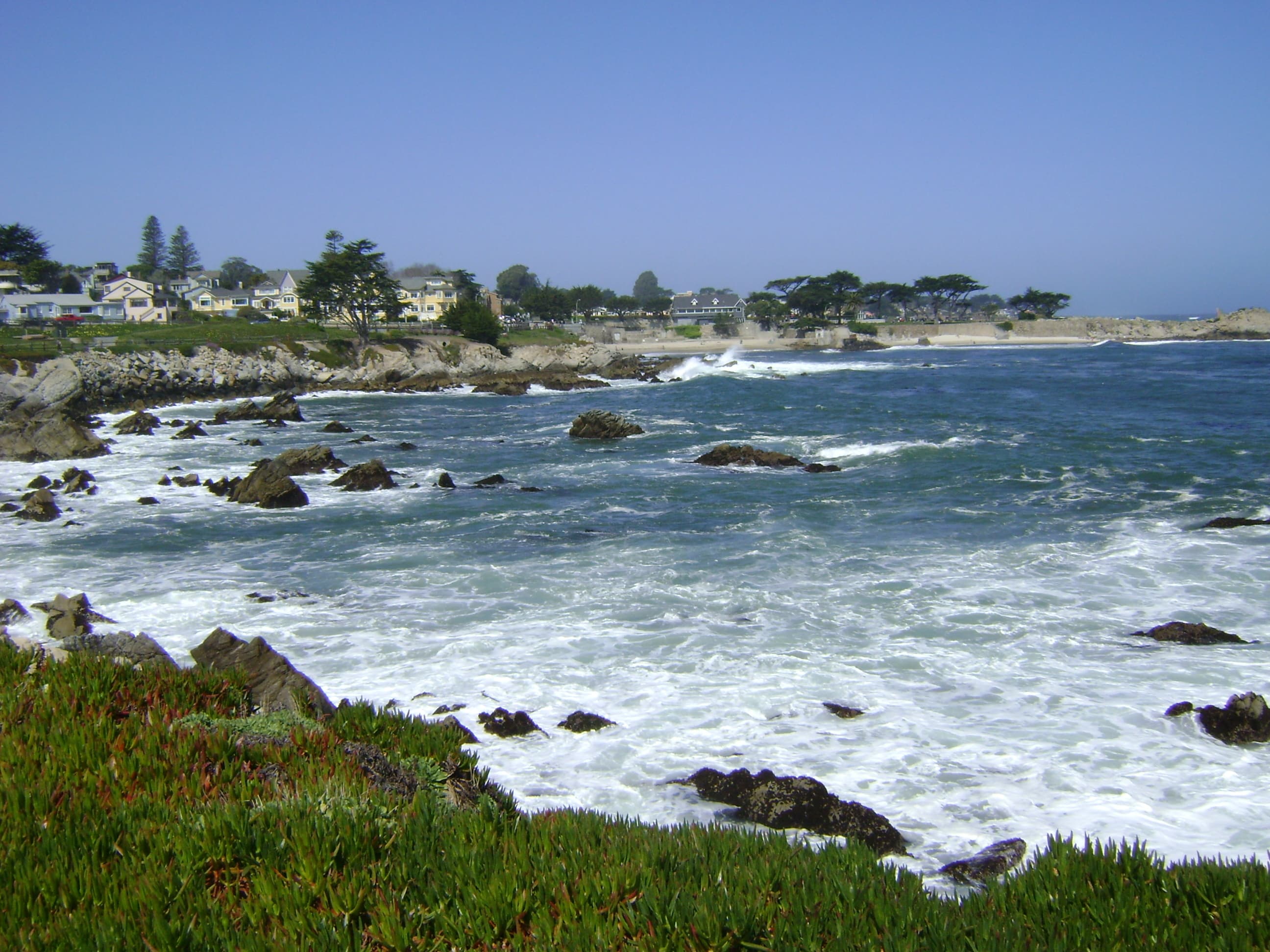
California's Central Coast. A weekend escape from the San Francisco Bay Area to Monterey, Big Sur, and San Simeon is surprisingly wild, with forests to get lost in, empty beaches to wander, and amazing food around each bend of the Pacific Coast Highway.
If these three weekend escapes whet your appetite for the road, read 15 Best Last-Minute Road Trips for more easy getaways.
Related places
 USA · California
State of California
 USA · Wisconsin
State of Wisconsin
 USA · Oregon
Bend
 USA · California
Big Sur
 USA · Massachusetts
Boston
 USA · California
Central Coast
 USA · Montana
Central Montana
 USA · Illinois
Chicago
 USA · Wisconsin
Door County
 USA · California
Monterey
 USA · California
San Simeon
 USA · Massachusetts
Cape Cod
- USA · Texas
Bay Area

#BTRoadTrip: Tucson to Del Rio, Texas
Hop in the passenger's seat on the ultimate road trip! We're posting real-time dispatches as Budget Travel's Photo Editor, Whitney Tressel, journeys across the country using tips from locals as her guide. Prepare for beautiful beaches and parks, amazing local cuisine, and one-of-a-kind experiences you only get when you talk to the real Americans who make this country great. When we last left our road-tripping heroine, Whitney had blazed through Arizona on her coast-to-coast journey, watching the seaside landscape in San Diego flatten into the Algodones Dunes and then taking the first sip of her new favorite drink: kombucha on tap—literally, probiotics on tap!—at "plant-based" (a.k.a. organic, locally sourced, and vegan-friendly) Food for Ascension Café in Tuscon. After laying eyes on the unmistakable silhouette of the desert's Picacho Peak, it was on to Las Cruces, New Mexico, via I-10—specifically the town of Mesilla, where Whitney spent most of her time. She'd gotten word that the restaurant La Posta de Mesilla dishes out the "best green chiles in town," so she pulled up a chair next to a group of friendly folks who recommended she take Route 28 to El Paso next. Reason being: It runs south through a string of pecan farms, with pecan trees reaching out from either side of the road to form a natural leafy archway that continues for miles and miles. After brushing up against the Mexican border in West Texas, once Whitney hit El Paso, it was time for a caffeine-drenched pit stop: fresh french-pressed coffee from Craft & Social. About three hours southeast of El Paso, the artsy celebrity haunt Marfa, Texas, appeared like a mirage. Whitney happened upon the famous Food Shark food truck, where cool young hipsters in combat boots, families, and in-the-know seniors alike were grabbing Mediterranean eats like falafel sandwiches ("Marfalafels") and lamb kebabs, among other Greek fare and, of course, tacos. (Beyoncé is reportedly a fan.) Less than a half hour east, in Alpine, Texas, Big Bend Brewing Co. is a choice place to grab a flight of local craft beers. Whitney admired the deep-amber-hued pints from a photographer's perspective, but she didn't imbibe. Maybe next time, when she's in the passenger's seat instead. Whitney's Travel Tip: Almost every gallery—or any other establishment, for that matter—looks desolate and closed in Marfa. Don’t be fooled! Check ahead and stick around to find the right entrance; most spots are open 10 a.m. to 6 p.m., depending on the day. Next stop: Crossing Texas, then sampling sweets in the Sugar State Previously: #BTRoadTrip: Los Angeles to San Diego#BTRoadTrip: San Diego to Tucson Want more? Follow @BudgetTravel on Twitter and Instagram, and look for the hashtag #BTRoadTrip. It all culminates in an epic photo essay in the July/August 2015 digital issue of Budget Travel.
#BTRoadTrip: San Diego to Tucson
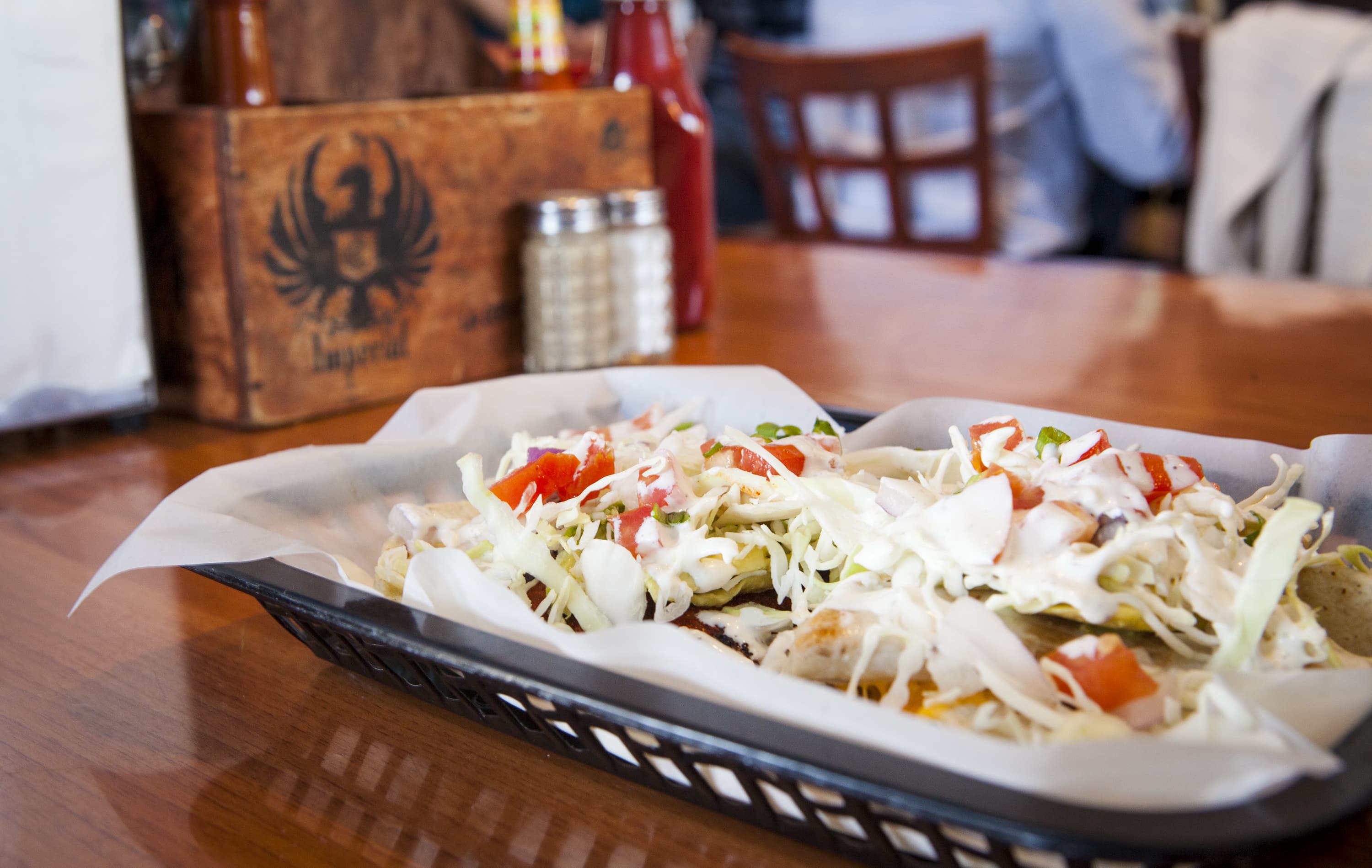
Hop in the passenger's seat on the ultimate road trip! We're posting real-time dispatches as Budget Travel's Photo Editor, Whitney Tressel, journeys across the country using tips from locals as her guide. Prepare for beautiful beaches and parks, amazing local cuisine, and one-of-a-kind experiences you only get when you talk to the real Americans who make this country great. Daybreak at San Diego's Sunset Cliffs Natural Park came dressed in a mellow haze of light fog—peaceful weather ideal for yoga at dawn. One young bearded man brought a bright red mat and meditated right on the rocks, a flock of gulls swirling in the background, palm trees dotting the horizon. Mindfulness aside, time waits for no woman, and Whitney was soon back on the road, on Route 5, in search of a dish true to the area. A local truck driver's recommendation? Blue Water Seafood Market & Grill, a blue-ceilinged fish shack where daylight pours in through the windows and photos of fishermen clutching prize-winning marlins cover the walls like a collage. She'd heard tell that Blue Water had the best fish tacos in the world. And the kicker is...they were. Less than five bucks bought Whitney a hearty mahi mahi taco (there are more than a dozen kinds of fish to choose from) and a fresh-outta-the-sea flavor she might spend her whole life trying to find again. Turning onto I-8, Whitney traced the Mexican border, weaving close to it, then skirting away when the highway leaned north. The diversity of the landscape was striking: Coming from the coast, the ocean vistas quickly twisted into a mountainous desert landscape, which in turn transformed into hills seemingly made of tiny pebbles. The roadside flatlined into deserts, followed by fields. When Whitney was just shy of Yuma, Arizona, the almost Moroccan-looking Algodones Dunes came into view, the sand's curves resembling perfectly whipped chocolate meringue, the peaks folding into valleys again and again. Ten miles west of Yuma, Whitney motored to Felicity, California, dubbed the Center of the World, a nearly deserted desert wonder first visible from far away—a tiny church on top of the highest sand dune. Once you're there, you can't miss the pyramid that holds the "official" center-of-the-world plaque, the sun dial featuring a bronze replica of God's arm from the Sistine Chapel, an original spiral staircase from the Eiffel Tower...or, when Whitney was there, the guy who had placed a fake skeleton in a lawn chair next to his truck, which we hope was a joke rather than an invitation. To see all four incongrous things in one strange place was disorienting. When you have a feeling like that, Whitney says, you know you're officially a road tripper. Whitney's Travel Tip: Lines for Blue Water Seafood Market & Grill can wrap around the corner. But a young San Diegan on his lunch break gave Whitney a tip only a local would know: There's a little side window at the restaurant designated for takeout. Ordering there won't get you your food any faster, but when lines are long, stop at the window first for a beer, then drink it while you wait in the queue. Next stop: The rest of the west. Previously: #BTRoadTrip: Los Angeles to San Diego Want more? Follow @BudgetTravel on Twitter and Instagram, and look for the hashtag #BTRoadTrip. It all culminates in an epic photo essay in the July/August 2015 digital issue of Budget Travel.
#BTRoadTrip: Los Angeles to San Diego
Hop in the passenger's seat on the ultimate road trip! We're posting real-time dispatches as Budget Travel's Photo Editor, Whitney Tressel, journeys across the country using tips from locals as her guide. Prepare for beautiful beaches and parks, amazing local cuisine, and one-of-a-kind experiences you only get when you talk to the real Americans who make this country great. We're starting our #BTRoadTrip strong, on an incredibly scenic stretch of road: the Pacific Coast Highway (a.k.a. Highway 1) just south of Los Angeles. Fruit stands often pop up along the highway, and Whitney couldn't resist grabbing two pints of ripe red strawberries for a grand total of $4 before taking in the scene at Tamarack State Beach, one of California's gorgeous Carlsbad Beaches. So many cars were pulling over that she initially thought there must be a festival going on. Nope! The pre-sunset tides were so ideal that droves of surfers were racing to the ocean on a mission to catch the perfect wave. After snapping shots of surfers suited up and expertly skimming the water, Whitney—a self-described "surfer poseur"—sat on the beach and ate her fresh, naturally sweet strawberries while looking out over the Pacific Ocean, at times seeing nothing but the heads of agile surfers bobbing up and down in the distance. Dipping 12 miles south on the PCH took Whitney a little longer than she'd anticipated, for the best reason possible: One of the great problems to have while driving along the PCH is there are so many places to stop and experience a brand-new ocean view, Whitney says. As she drove, picturesque vignettes of the ocean kept appearing to Whitney's right, one after the other. Finally, in Del Mar, south of Encinitas, Whitney stopped at a vantage point high enough on the cliffs to see cascading layers of waves lapping at the shore, juxtaposed with cars zooming by on the highway, mere feet away from the sand. The end-of-the-day cherry on top of Whitney's San Diego route? Sunset in La Jolla, another 12 miles down the coast. But as Budget Travelers know, the destination is secondary to the journey: En route to La Jolla, she sailed past Torrey Pines State Natural Reserve, veering right on Torrey Pines Road to witness a sudden magical canopy of undulating, nature-twisted torrey pine trees. Professional photographer or not, Whitney says the fairy-tale surprise is enough to make anyone instinctively reach for their camera. She did. Down the road, at La Jolla Cove—famous for the hundreds of seals who call it home—she made it just in time to catch the Pinterest-worthy sunset pictured above. An ocean-loving gull glided into the frame at the very last moment. Whitney's Travel Tip: At La Jolla Cove, wait 15 to 20 minutes after the sun sets and the rest of the visitors leave to watch even more vibrant colors appear. Next stop: The American Southwest. Want more? Follow @BudgetTravel on Twitter and Instagram, and look for the hashtag #BTRoadTrip. It all culminates in an epic photo essay in the July/August 2015 digital issue of Budget Travel.
For Daring Drivers Only: The World's Scariest Roads
This article was written by Greg Keraghosian and originally appeared on Yahoo Travel. Maybe someday, Doc Brown will be right. Maybe we won’t need roads. But until we all get a flying DeLorean, we’re going to be using them in our travels, and often they’re a big part of the fun. For some, that fun requires trying not to die when you’re driving said roads. If you just can’t feel satisfied without navigating hairpin turns, dizzying elevations, and gravel surfaces with no guardrails to protect you, we’ve got you covered with this bucket list of freaky routes. Some of these are highly traveled destination roads, some get very little traffic, and others are obscure to most drivers. But if you can patiently and carefully handle them in the proper vehicle, you’ll be rewarded with some tasty visual treats, plus access to unique mountain-climbing and cycling adventures. We’d tell you to buckle up, but we’re not sure how much that will help you here: Lippincott Mine Road, Death Valley National Park, Calif. This little-used 7-mile route in and out of the park near the famous Racetrack Playa really puts the “Death” in Death Valley. It’s a faster route to the park than others, but you might be clenching your jaw the whole way trying not to fall hundreds of feet to oblivion, and it’s not for the casual driver or the casual car. This is four-wheel drive territory only. My friend Doug did the honor of driving us out of Death Valley via Lippincott at the end of our camping trip last fall, and by the time we had slowly descended the almost-2,000-foot drop, I felt like the park had chewed us up and spat us out into Saline Valley. What could kill you here? Let us count the ways. There are no guardrails, and there is the constant threat of a steep fall if you’re not careful—at times, there’s just a foot or two of gravelly space to navigate. You’ll be driving around or over some large rocks that could break down your vehicle, and if that doesn’t do it, the park’s intense heat could if you’re making the uphill climb into Death Valley during the hotter months. There’s no towing service, no water source, no road signs, and no cell reception. Other than that, this drive is like Christmas. Still, competent drivers in the right vehicle can make this trip safely. Make sure you stop along the way to capture some gorgeous views of the valley below. Also, if you enter the park this way, you’re just three miles from the Racetrack and its otherworldly beauty. Just play some Metallica at full blast as we did in this video clip to give you the adrenaline rush you need to survive. Road of Death (North Yungas), Bolivia There’s nothing ironic about the name of this 38-mile journey that goes from over 15,000 feet in La Paz to 3,900 feet in Coroico—it is the black widow of roads. Its claim to fame is being named the world’s most dangerous road by the Inter-American Development Bank, and it’s estimated that 200 to 300 people traveling on it die each year. It’s not hard to see why the road is so dangerous: It’s barely the width of one vehicle, with no guardrail to protect you from falls of up to 2,000 feet. Rain can make the road muddy and slippery, and rain or fog can reduce a driver to feeling blindfolded. Still, there’s a siren song here that attracts thousands of people, from danger-loving tourists to hardcore cyclists. The view of the Amazonian rain forest is astounding, and standing right over the sheer drops here will bring out the lemming in many of us. Tour groups that serve the road include Barracuda Biking and Gravity Bolivia. Trollstigen Mountain Road, Norway As dangerous roads go, this is among the most visited in the world, and for good reason: It overlooks a UNESCO World Heritage Site, the Geirangerfjord on the west coast of Norway. I’d like to say that I gave death a noogie as I raced this road’s 11 hairpin turns and 9 percent incline in an Alfa Romeo, but in fact, I slowly weaved through it on a large tour bus. Next time, I swear. Dangerous conditions here include the incline, narrow driving space, and the poor traction and visibility that come with rain and fog. But oh man, those views: There are ideal photography opportunities where you can pull over and capture the fjords and lush valleys below, and waterfalls so close you can touch them. Note: The road closes in October and opens in May. Related: A-ha! The Ultimate All-Norwegian Playlist for Exploring Norway Road to Hana, Maui, Hawaii Paradise is worth the risk, which is why the 42 miles of Highway 360 to Hana in eastern Maui are such a tourist favorite. You’ll have to navigate through and around 600 hairpin turns, 54 one-lane bridges, steep cliff drops, falling rocks, and even some confusing mile markers that reset. Plus it rains often, so there’s that. But the rewards for your risk are considerable: You probably won’t have time for them all, in fact. The road itself is full of pull-over-right-now photography opportunities, but venture deeper and you’ll find such rare beauties as Wai’anapanapa State Park’s black sand beach, Twin Falls, Wailua Falls, and the laid-back charm of Paia Town. Drive slow and you’ll be fine here—you’d better, in fact, because police strictly enforce the 25 mph speed limit. Related: Life Lessons from Maui: What I Learned Driving the Crazy Road to Hana Dalton Highway, Alaska While the Road to Hana is seductively warm and dangerous, this frosty, gravelly, pothole-laden route is as seductive as a White Walker in Game of Thrones. The Dalton Highway was opened for one thing: transporting oil. And it covers 414 miles of desolate, icy terrain. This is the route of Ice Road Truckers fame, and you’ll have to excuse the truckers for thinking you’re crazy if you want to drive this highway for fun. Let’s put aside the freezing cold and often-miserable road conditions, with 18-wheelers pounding your vehicle with ice. On a single 240-mile stretch, there are no gas stations, restaurants, or basic services—the longest such stretch in North America. There are three—count em, three—gas stations the entire way. And don’t count on cell service at all. Still, there are enticements to taking your chances here. You can say you’ve crossed into the Arctic Circle, which the highway does. And if you visit at the right time, you can slowly pull over and watch the northern lights. A guide is highly recommended here unless you know your survival skills, as you’ll need to pack provisions, including gas. And be on the lookout for freeway closures, such as the one that happened just after flooding from the Sagavanirktok River. Related: An Alaskan Adventure—Ice Road Trucking Under the Northern Lights Karakorum “Friendship” Highway, China and Pakistan For some real altitude, take your chances with this 800-mile drive. At 15,397 feet, it’s the highest paved international road in the world. And you can get a sense of how dangerous it is just by knowing that about 1,000 workers died building this freeway before it opened in 1979. The road’s nickname stems from the collaboration between China and Pakistan in building it, but it can be unfriendly in practice, with little driving room, sheer drops, no pavement on the Pakistani side, and flash floods. However, Karakorum is an adventure lover’s delight. Comprising part of the old Silk Road trade route, it offers views of soaring mountain peaks such as the K2 (second-highest mountain in the world), massive glaciers such as the Baltoro, and sprawling rivers such as the Indus. Skippers Canyon Road, Queenstown, New Zealand Welcome to a road so dangerous, your rental car insurance won’t be honored if you drive on it—only one other road in New Zealand has that honor. Yet you will be tempted to drive this one-lane, twisting terror with steep drops because it abounds with natural beauty and photo ops, including the Shotover River directly below you. Skippers Canyon Road is cut into the side of a mountain and extends 16.5 miles in New Zealand’s South Island, 25 miles from Queenstown. It’s considered one of the country’s most scenic routes. The miners who built the road in the late 1800s didn’t think much about luxury, though—it’s unpaved and very narrow. Should you encounter a car driving the other way, one of you will have to back up gingerly until you can find enough room to pass. Good luck figuring out which of you that will be. For an adventure trip, you can hire a tour bus to do the driving for you, such as a jet boating tour with Skippers Canyon Jet. Fairy Meadows Road, Pakistan Is climbing the world’s ninth-highest mountain not challenging enough for you? Fine. Just try driving to the base of it. If you want to climb Nanga Parbat, you’ll have to ascend six death-defying miles to Fairy Meadows. The gravel road is completely unmaintained, there are no guardrails to protect you, and it gets so narrow that near the end you’ll have to cover the last section by walking or biking. The road is prone to avalanches and heavy snowfall, and it closes in the winter. Los Caracoles Pass, Chile If you impressed yourself by driving down the curves of Lombard Street in San Francisco, this is just like that, only 1,000 times more challenging. Called the “Snails Pass” by locals, this serpentine mountain pass in the Andes connects Santiago, Chile, to Mendoza, Argentina. It reaches 10,499 feet in elevation, and this being in the Andes, it’s known for getting heavy snowfall: About 15,000 travelers were stranded for 10 hours on the Argentine side in 2013, when the road had to be closed because of snow and cold. When you reach the summit of this road, you’ll pass through the Cristo Redentor tunnel, and the heaviest, steepest switchbacks are on the Chilean side. You may need tire chains and plenty of patience to make it through here, but if you take your time, you should be able to avoid an accident. Bayburt Of Yolu-D915, Turkey We’re saving our most obscure road for last, though it’s arguably more dangerous than any other on this list. The D915 connects the Turkish cities of Bayburt and Of, near the Black Sea, and it spans 66 miles. It has many of the same hazards of the Death Road in Bolivia: It’s only a lane wide in some sections and unpaved, with elevation exceeding 6,500 feet and no guardrails protecting you from certain death. The often-poor weather adds to the danger. Says the website Dangerousroads.org, “Words can’t describe the road and pictures don’t do it justice… the steep part is simply terrible. Curvy roads descending down the cliffs, often so narrow that you cannot turn the first time.” There are 29 hairpins turns, and things get gnarly in Çaykara, where the road climbs from 5,616 feet to 6,676 feet in just 3.1 miles, with 13 hairpin turns.